An hour north of Charlottesville is where we headed for our first visit to Shenandoah National Park (SNP) to hike up Old Rag Mountain. We visited once more for a short backpacking trip. Shenandoah National Park was was established in 1925 and opened in 1936, is known for its Skyline Drive, over 100 miles of the Appalachian trail that runs through its boundaries, its beautiful Blue Ridge mountains, and several scenic waterfalls. Many come here to drive or bike along Skyline, hike, or camp and enjoy the natural beauty that the Appalachian mountains has to offer.
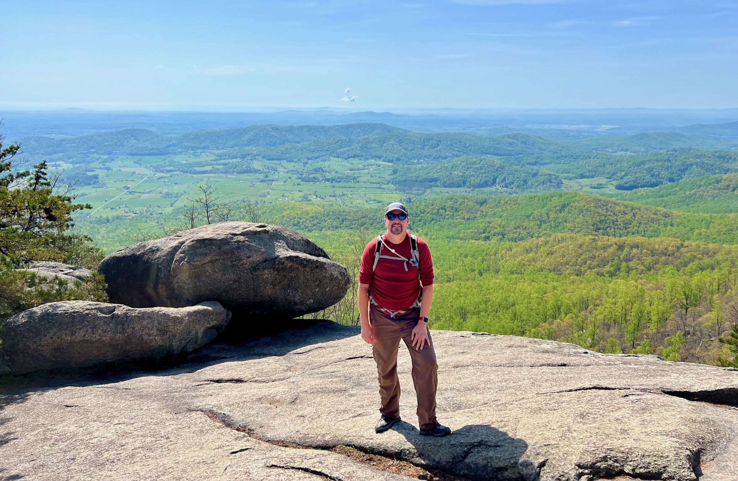
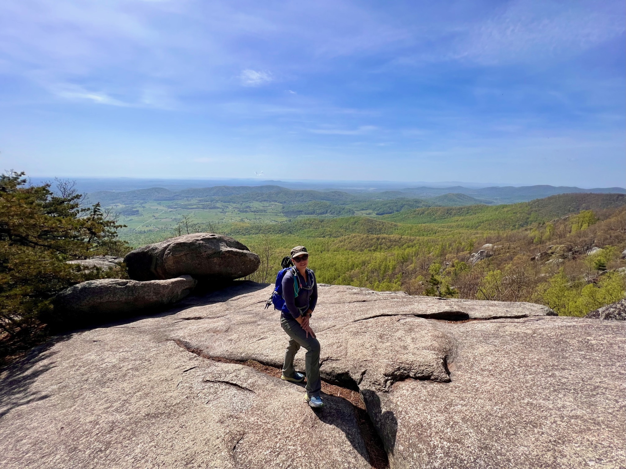
Old Rag Mountain
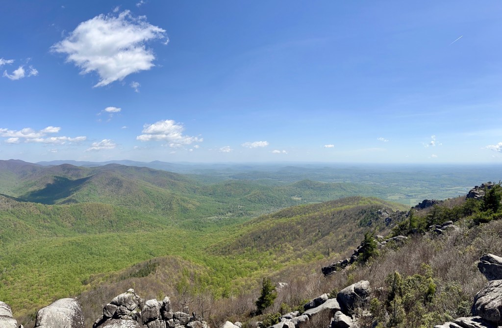
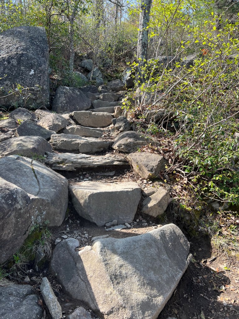
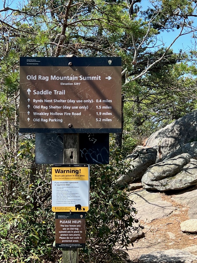
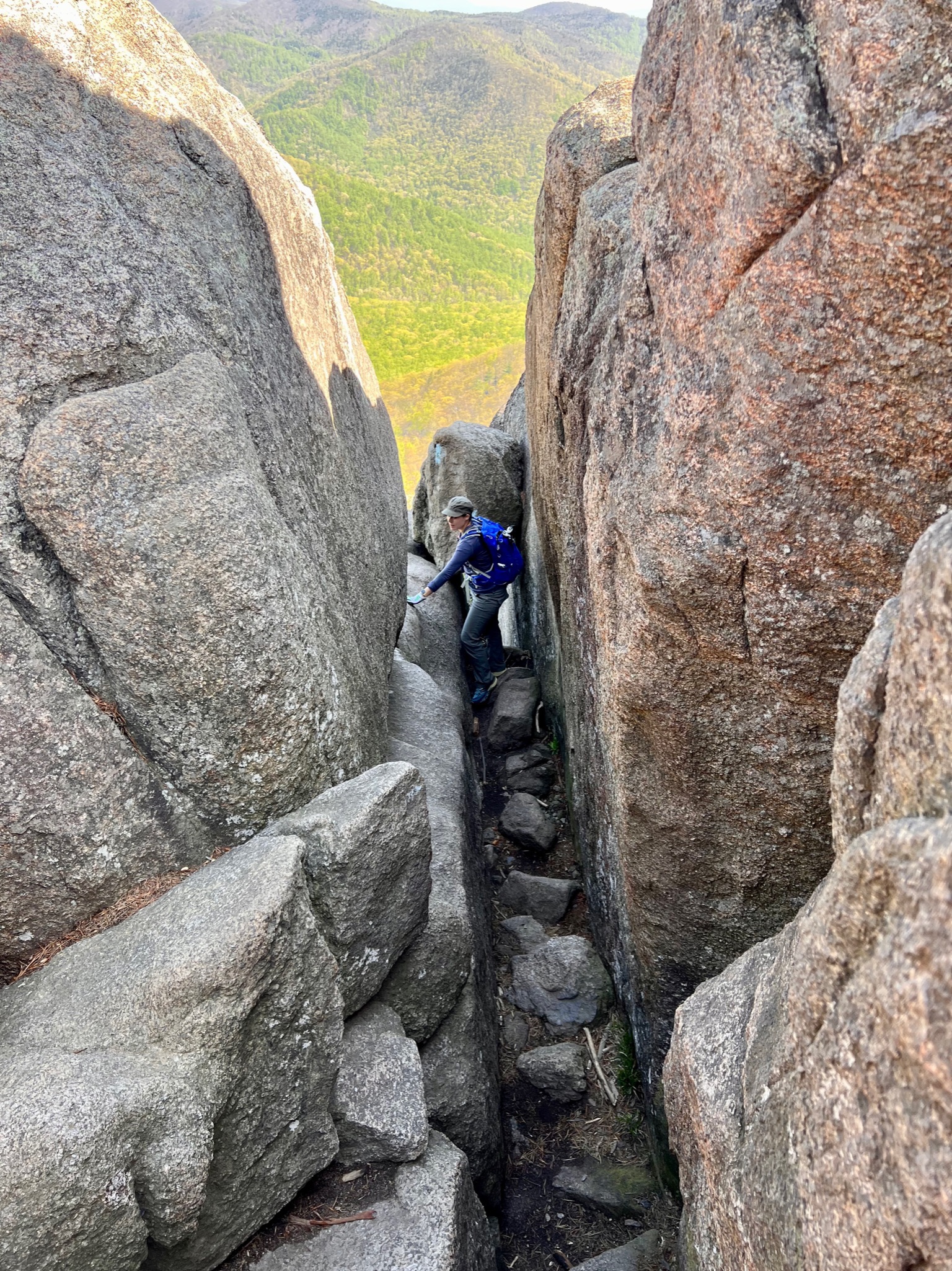
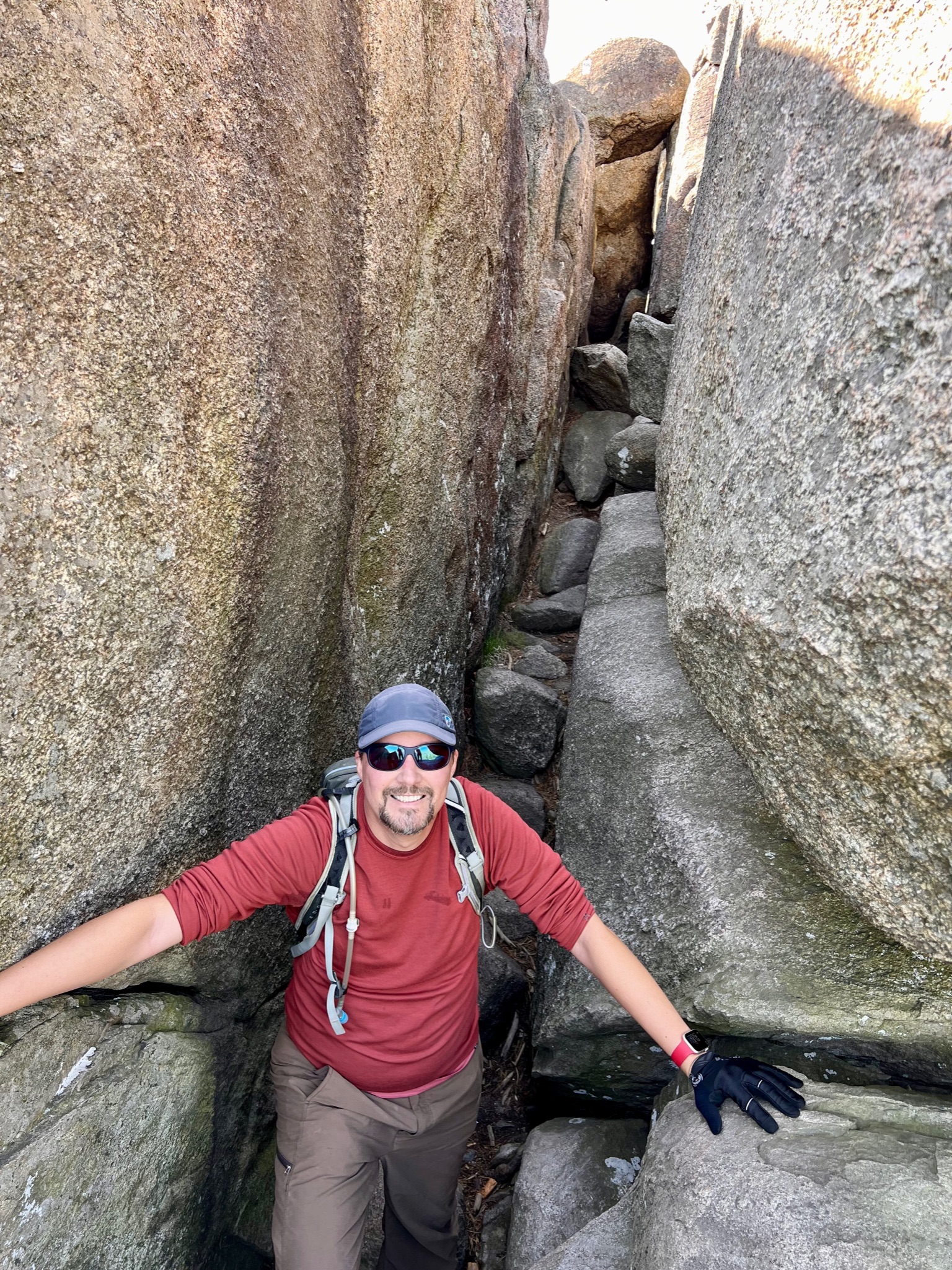
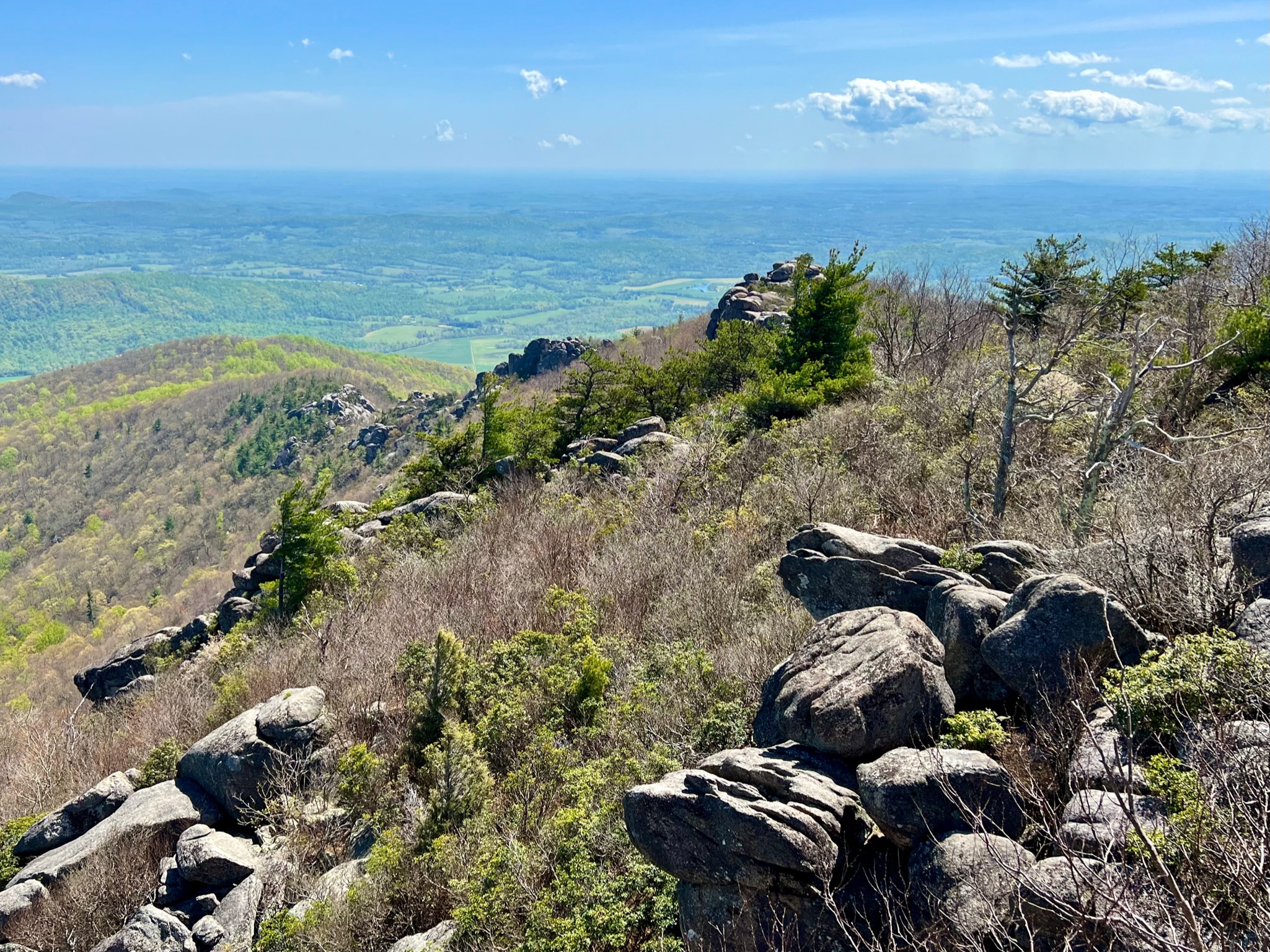
This hike is definitely one of the more challenging ones we have done, at roughly 9.5 miles long, over 2600 feet of elevation gain, and about a mile of clamoring through boulders to get to the top. Yet, it was one of the most enjoyable and rewarding hikes we have ever done. Rag Mountain is one of the most popular hikes in SNP, and requires an additional day pass (it’s only $1) in order to limit the number of people that can access the trail, which was wonderful, likely for all involved.
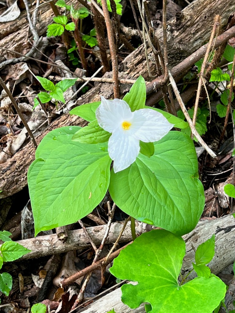


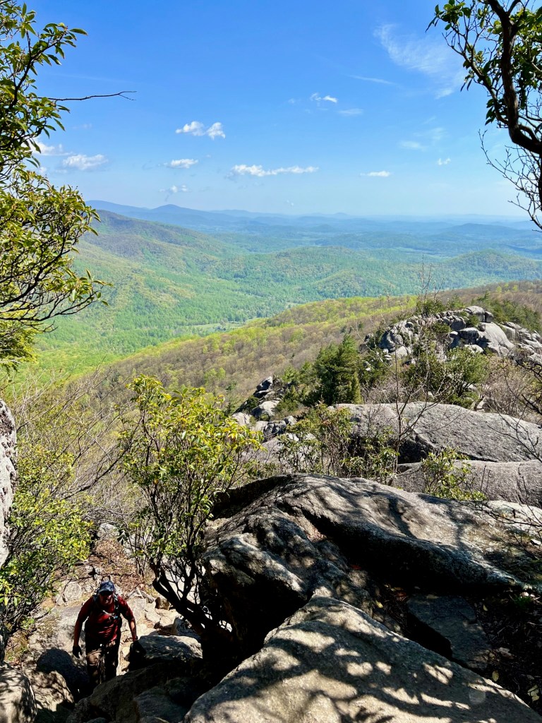
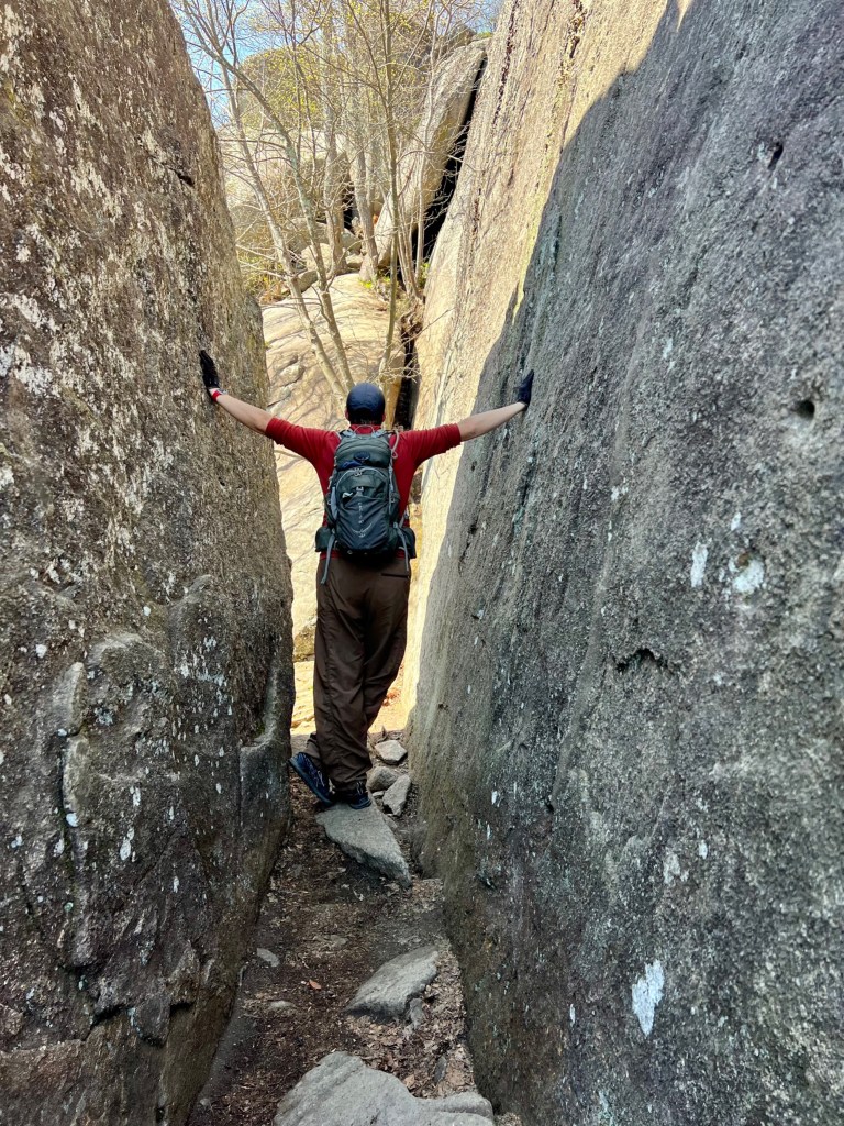
Because it’s early May, violets, trillium, wild geraniums and chickweed blooms dotted the trailside, and the views you get as you reach the false summit and beyond are breathtaking and expansive. Getting through the boulder section near the top of the climb was also really fun and made the hike a lot more interesting than most. It wasn’t nearly as scary as some make it out to be, and I’m a bit of a scaredy cat when it comes of hikes and potential falls, so that’s saying something. Top this off with the fact that the weather was perfect and the trail wasn’t overcrowded, and it made for a memorable and positive experience. I would definitely come back to visit and highly recommend this hike if you are looking for a little bit of a challenge.

Backpacking in Shenandoah’s North District
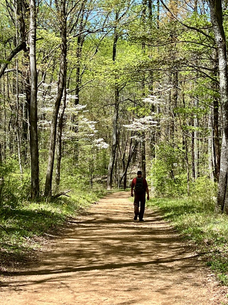
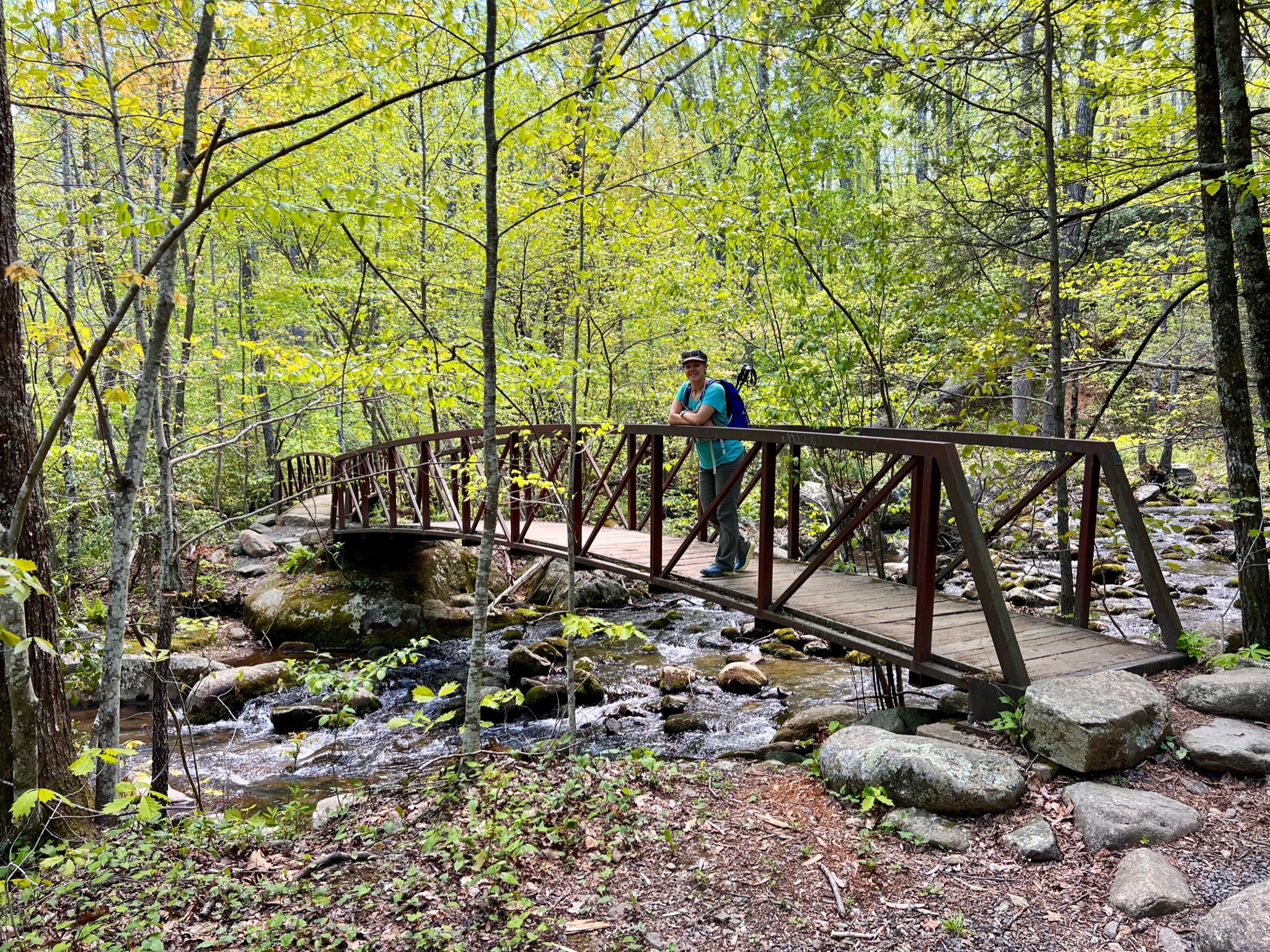
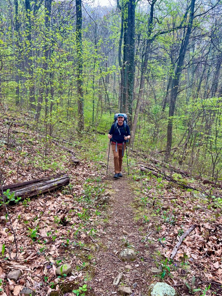
I was determined to go backpacking during our time here, because it’s spring and we may not get a chance again for a while. The north and south districts of Shenandoah National Park (SNP) aren’t as popular as the central district, so we decided to try this loop for a quick 2-nighter. The weather was not being cooperative, so we were trying to find a window to make this happen without getting caught in a thunderstorm, and shortened the route slightly by parking at Mathews Arm Campground to cut out the Appalachian trail portion. We hiked in on a Wednesday and left it open to either push it and hike out Thursday or take it easy and hike out early Friday.
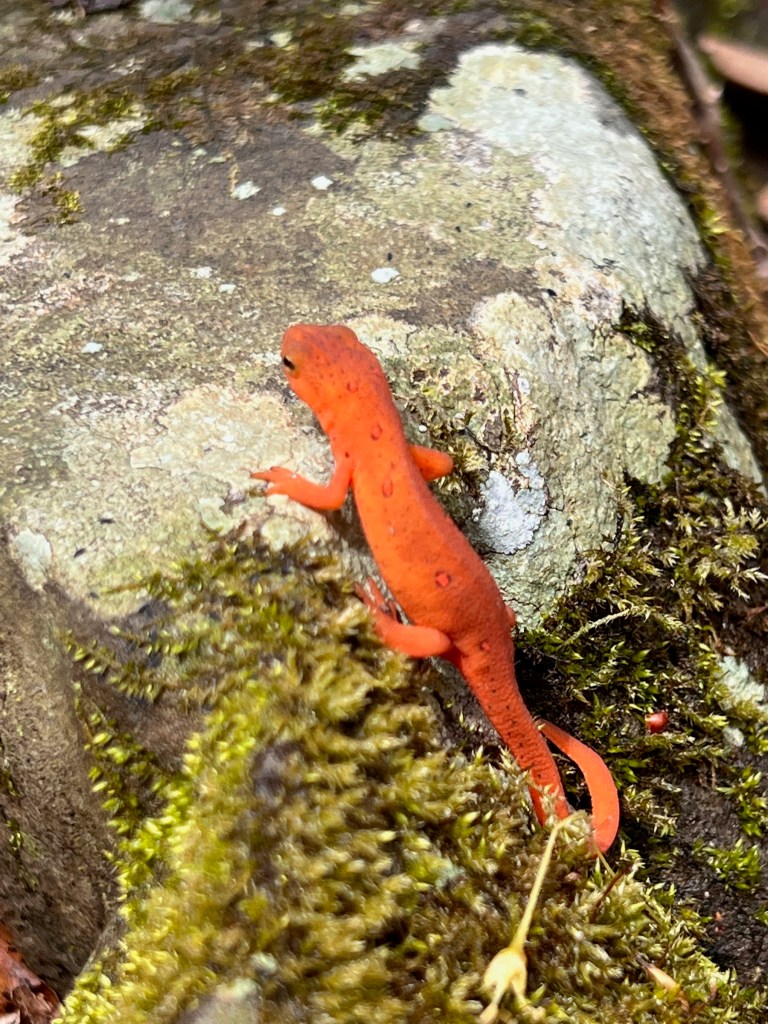
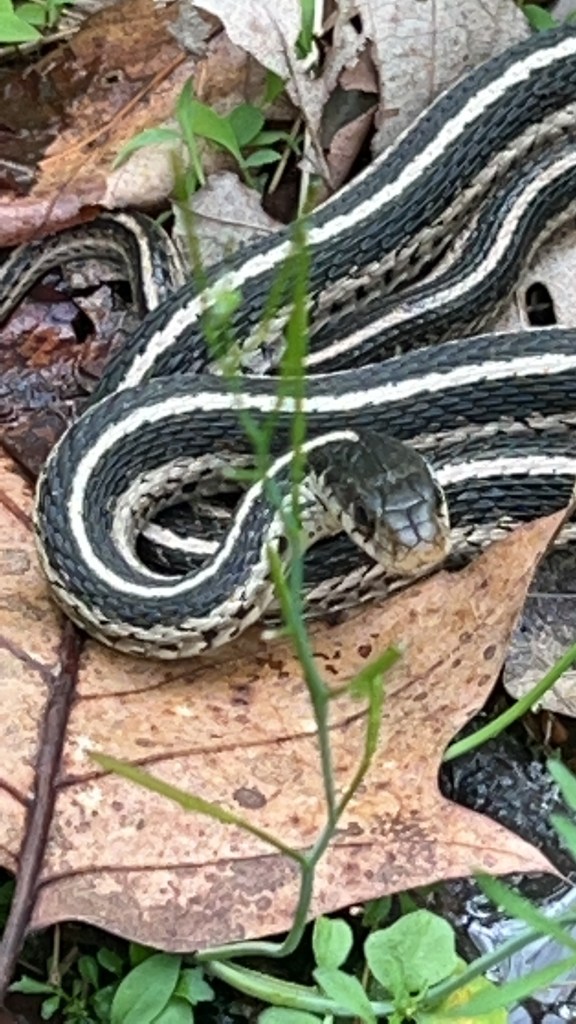
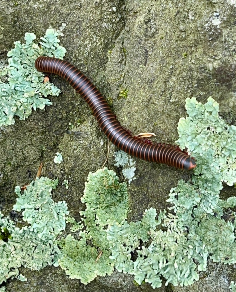
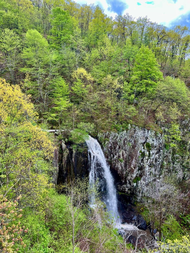
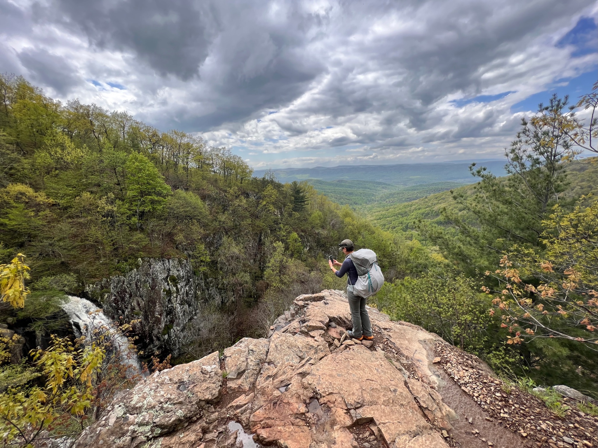
As we were arriving, a short rain shower commenced, so we hung out in the truck, ate our lunch and waited until it had passed. The sun was out soon afterward and we began our trek. Having just rained, we saw lots of little creatures on the trail, including toads, a newt, several millipedes, garter snakes, and Matt even saw a salamander. The trails were a bit flooded, but otherwise seemed to be in good condition and soon enough we were at the largest falls in Virginia: Overall Run Falls. At over 80 feet, the falls this time of year are grandiose. Where you can see the falls there are also expansive views of the valley below and the Blue Ridge Mountains in the background. If you want a picturesque day hike, this is it.
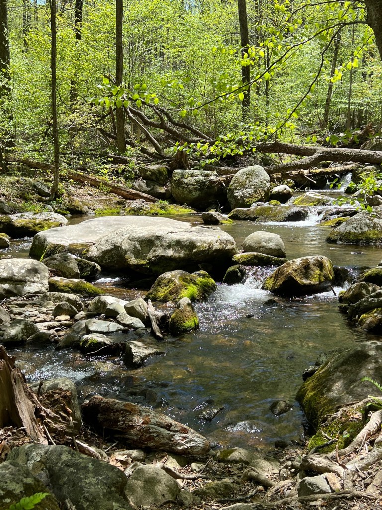
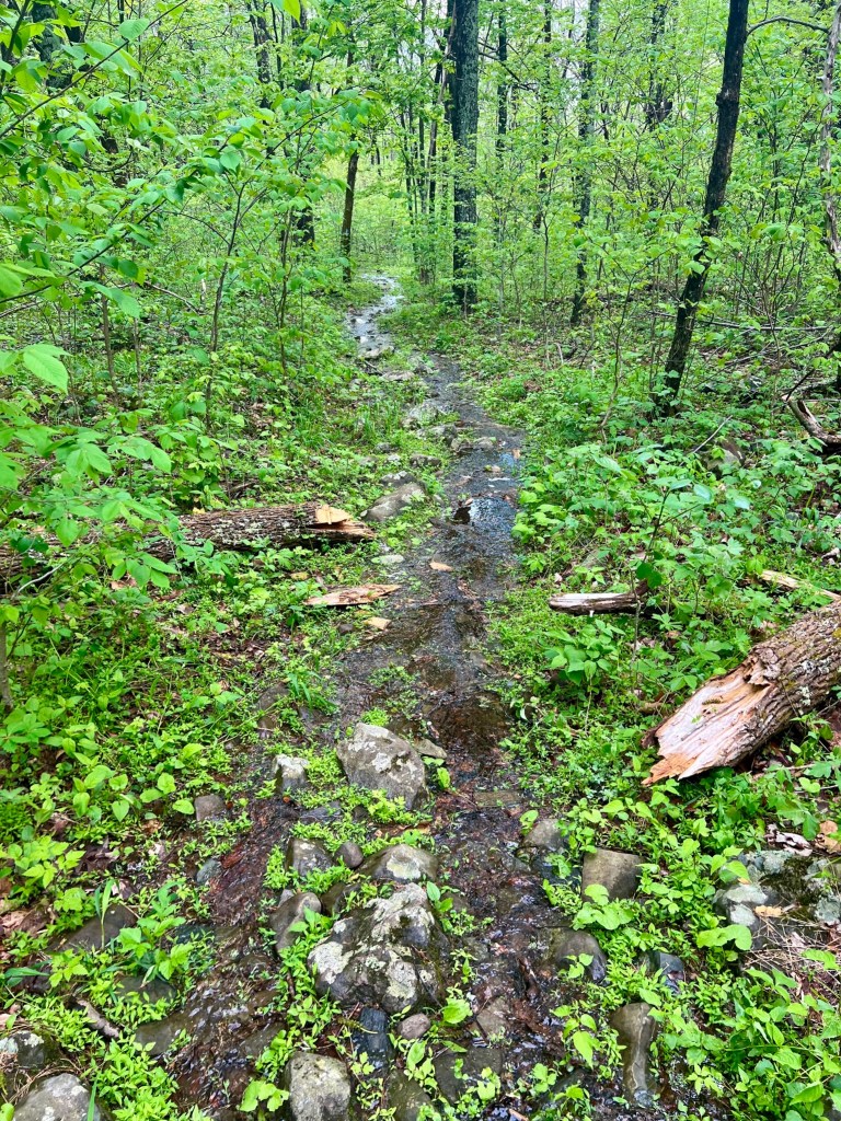
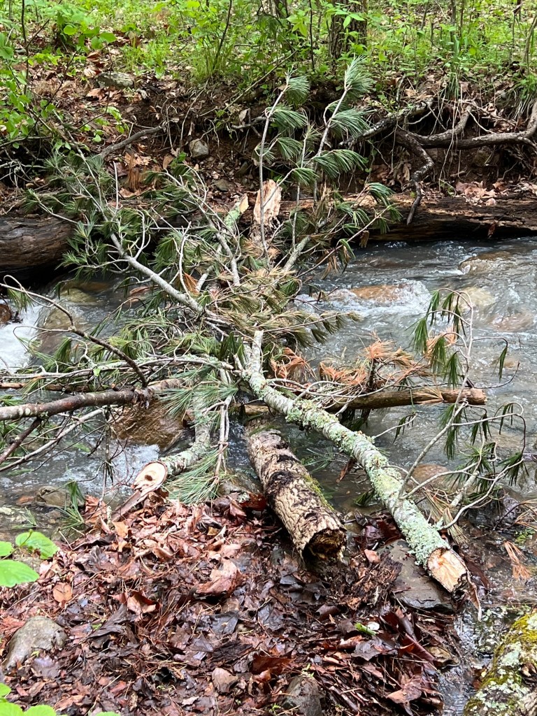
We saw three couples near the falls, and pressed on into the valley basin. Next up were some rather precipitous switchbacks that were wet, muddy, and rocky, which meant we had to be very deliberate about our foot steps. We finally made it to the bottom and thought the rest would be pretty easy. Wrong, wrong, and wrong. Had I known what we were in for, I may have stopped at one of the two campsites we saw just below the falls. Most of the trails in the basin were flooded and had also become contributories to the river runs. If that weren’t bad enough, there are no bridges to cross the river runs, and they were running high with strong currents this time of year. We managed to find a precarious impromptu log bridge at the first crossing of Overall Run, but then had to bush whack through areas filled with poison ivy and ticks to try and find options to cross Overall Run again. We didn’t find anything.

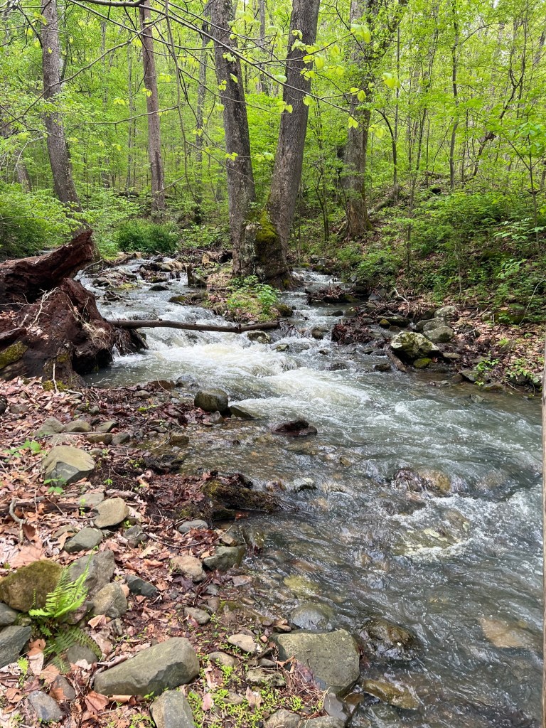
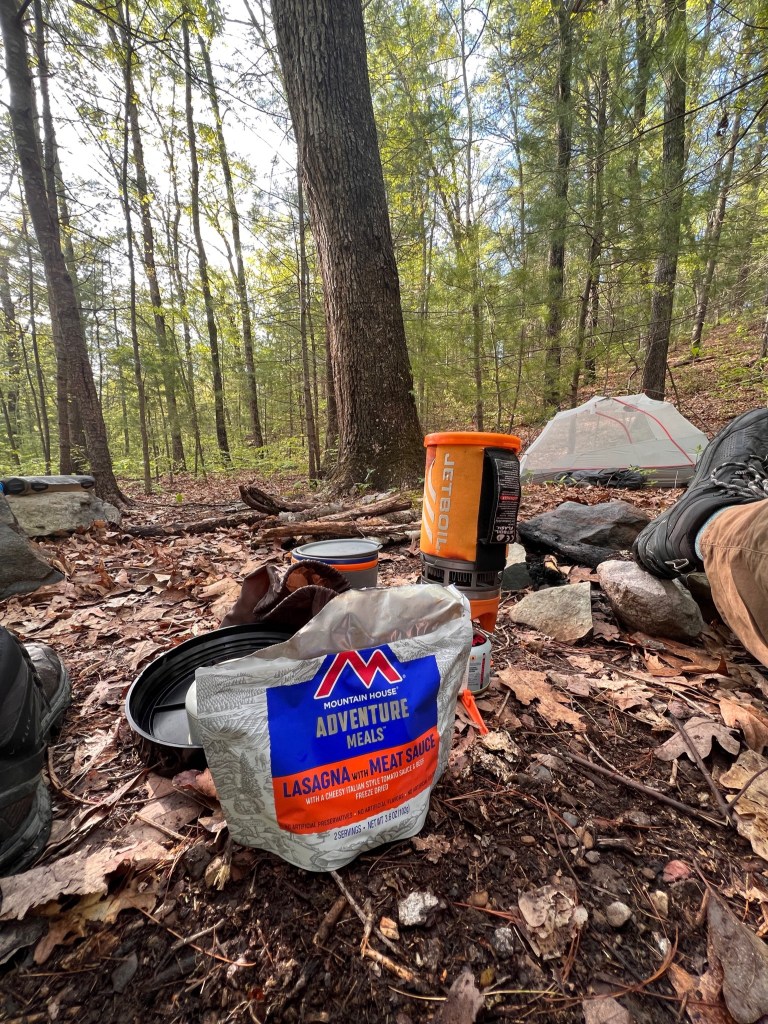
We were about to abort, but I decided to try going barefoot with my pant legs hiked up high to attempt a crossing. It worked, but the current was indeed strong and I was up to my knees in water. We both managed to make it across, and thankfully didn’t have to do anymore major crossings that night. We found a lovely campsite, the sun came out, and we had a really relaxing evening, especially knowing we had the whole place to ourselves. 🏕
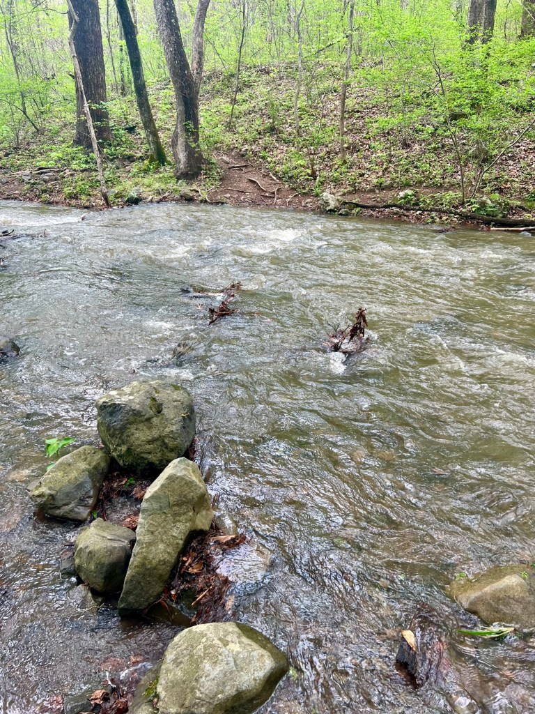

Given the impending rain forecasted to start early on Friday, and having seen how flooded everything was already, we chose to hike back out on Thursday so that our 2400-foot elevation gain would not be made more miserable by being soaking wet on top of it. We had made a game plan for the next Overall Run river crossing with another impromptu log bridge we found, but this run had split into two sections, and the next crossing had nothing to offer. So, we got resourceful and built our own log bridge with what we could find lying around near the water. It worked and we made it across! 😀
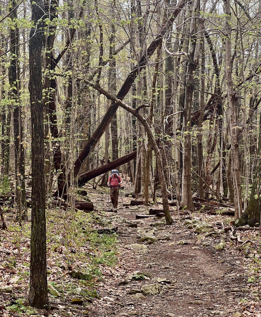
We knew we had at least two more major river run crossings, but the next one called Keyser Run turned out to be smaller and easily managed. At this point, we thought we were home free, but the last crossing of Compton Run turned out to be another challenging one. We built another log bridge and made it across. Phew! Now we just had to finish hauling our butts up the mountain. We saw a solitary man heading down, but no one else. After finally making it back up, we were thankful to have finished. I would not do this hike again unless it was much later in the season when the river runs die down and the crossings are not an issue. I can tell that these trails do not get a lot of use or are as well maintained after you pass the popular Overall Run Falls.

If you’re looking for solitude, you can get that in spades here, but make sure to bring bug spray, wear long pants because of ticks and poison ivy, wear shoes with water proofing material, and be prepared to get wet crossing rivers in the water or to build your own crossings. If you don’t like that much of an adventure, camping near Overall Run Falls is an option. Otherwise, something closer to the central Shenandoah NP region may be better maintained, and also have more people frequenting the trails.

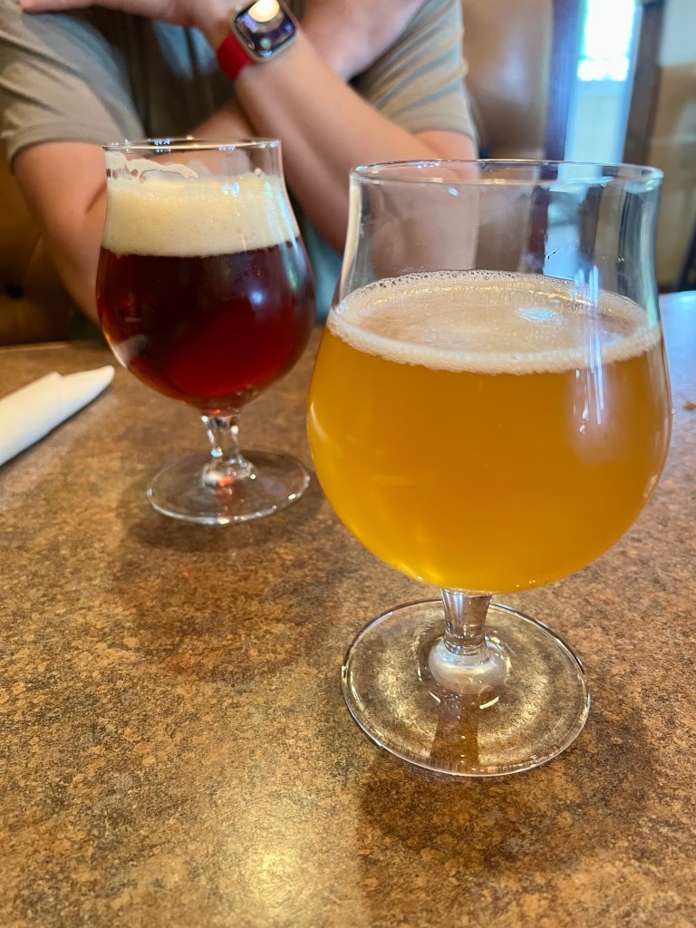
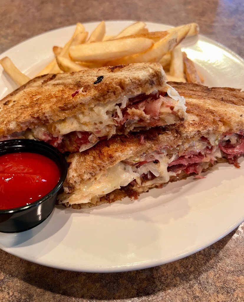
After hiking back out, we stopped at the Headmaster’s Pub in Sperryville on our way back to get a well-deserved beer and lunch. This establishment has a large outdoor patio and adjoining game room as well as the main bar area with booths. I ate their reuben with fries and Matt got their Headmaster burger. We always like to get a burger and a beer after backpacking, and this was just what we were looking for. 👍
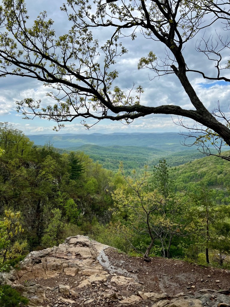
Our time in Shenandoah was not extensive, but there were several incredible views from Skyline, and plenty of areas to explore that weren’t overly crowded (at least in the springtime). If you love those mountainous views and don’t mind some more rugged trails, this area is beautiful and provides some rewarding hikes.

The first hike sounds amazing! I love seeing those orange newts! The second hike sounds awful – I hate hiking when it’s wet like that. I’m shocked by how flooded those trails were!
LikeLiked by 1 person