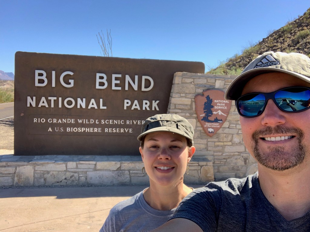
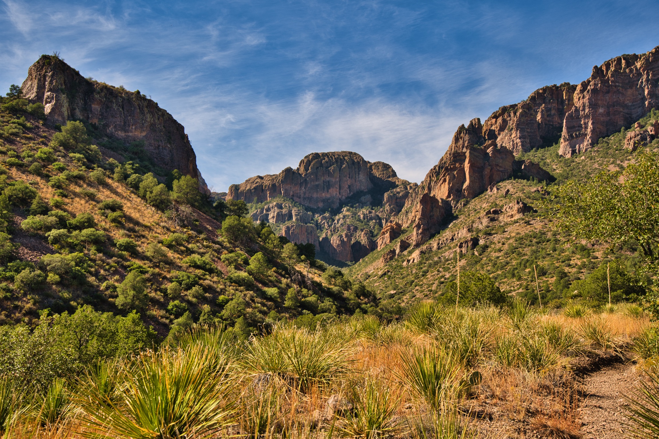
We absolutely loved our stay in Big Bend National Park and it has become one of our favorite national parks we have visited so far. The park is huge! You could spend a LOT of time here and still not see everything. Though, to be fair, to explore some sections of it you will need a four-wheel drive or off-road vehicle. Here is a little taste of what we saw during our three-day stay. A general note: download maps of the Big Bend region before you get there, because there is little to no internet or cell service.
Cottonwood General Store:
We headed down the road to Big Bend from Alpine and realized that we forgot our grill. Doh! We did have our JetBoil, but weren’t confident we had enough fuel for the JetBoil. We stopped off at another store on our way, and they suggested we go to the Cottonwood General Store. My oh my is this the place to go! It’s an oasis in the middle of the desert. They have groceries, beer and wine, automotive, camping, over the counter drugstore, lawn and garden, pet store and more supplies. I was amazed around every turn in this place and very impressed with their selection. So, if you forget something at home, have no fear! There is a high likelihood that the Cottonwood General Store will have what you need. 😊
Santa Elena Canyon Trail:
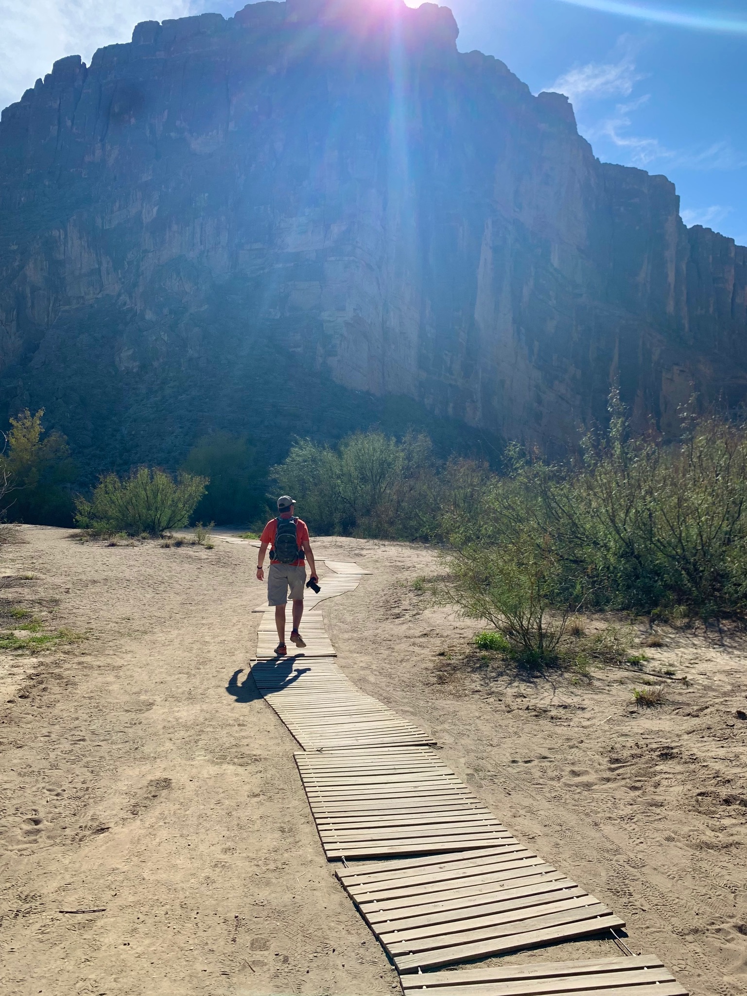
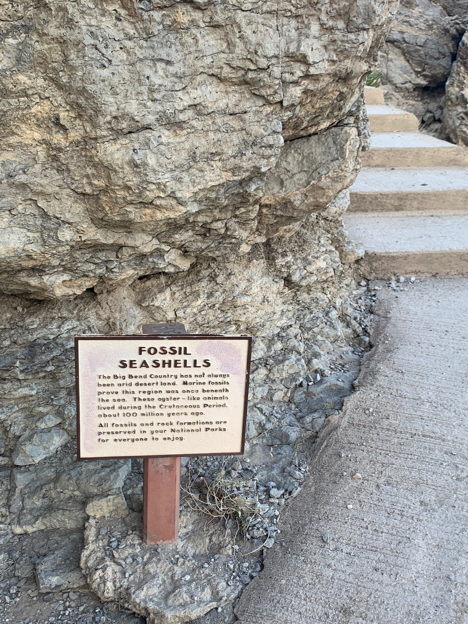
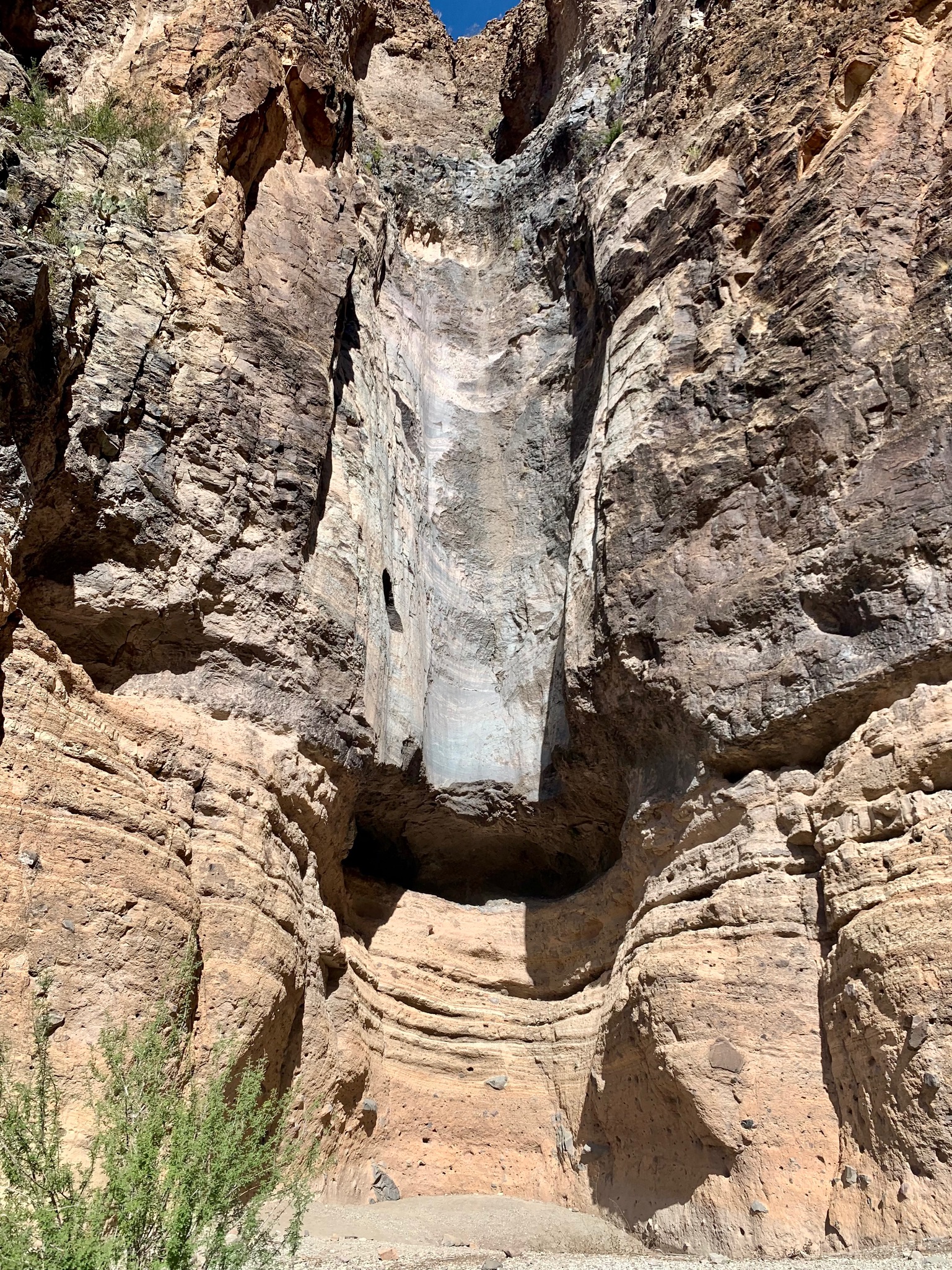
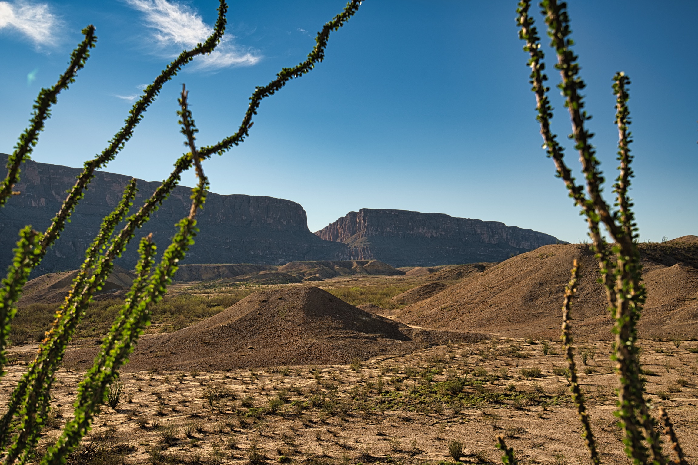
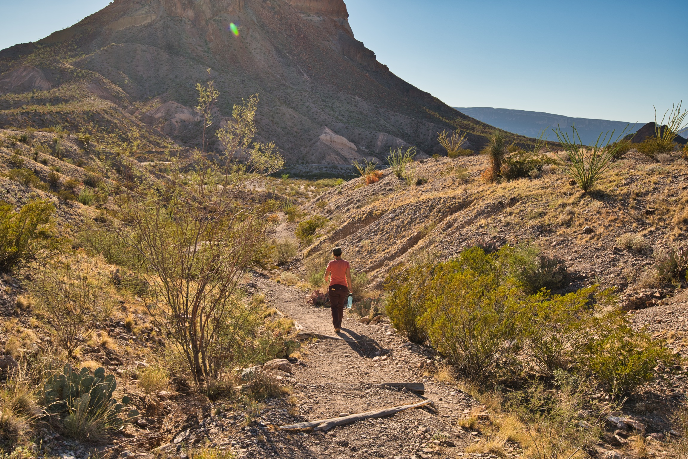
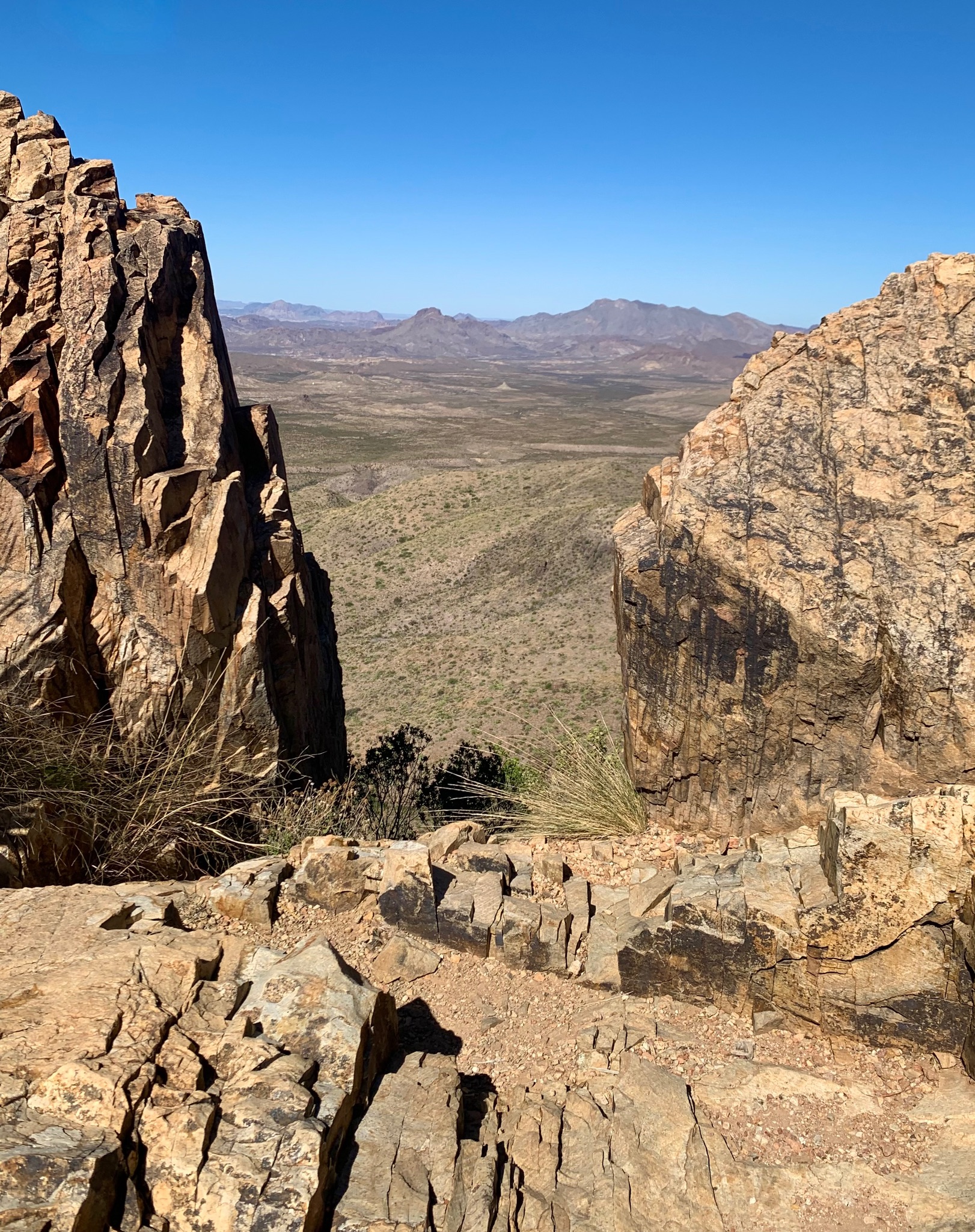
Not wanting to waste any daylight, we headed straight to the Santa Elena Canyon Trail after lunch. This canyon marks the border between the United States and Mexico, and you can see where people have walked through when water levels were lower. Not only is the canyon quite imposing with it’s sheer size (think of the great wall of the north in Game of Thrones), and the sunlight slicing through the cavernous gap dances on the water and provides a beautiful backdrop to the multi-layered rock walls.
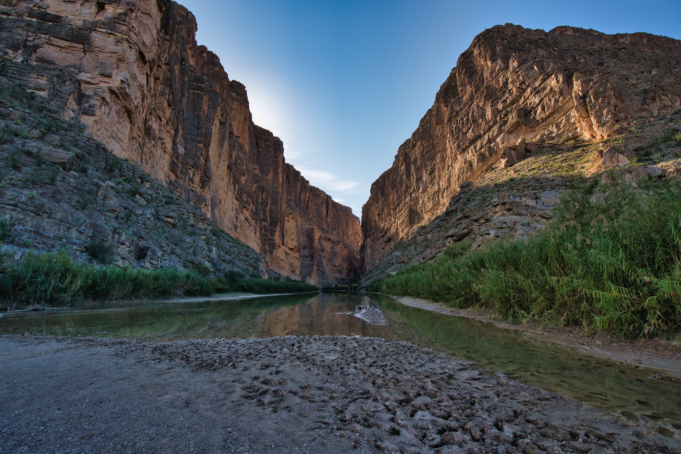
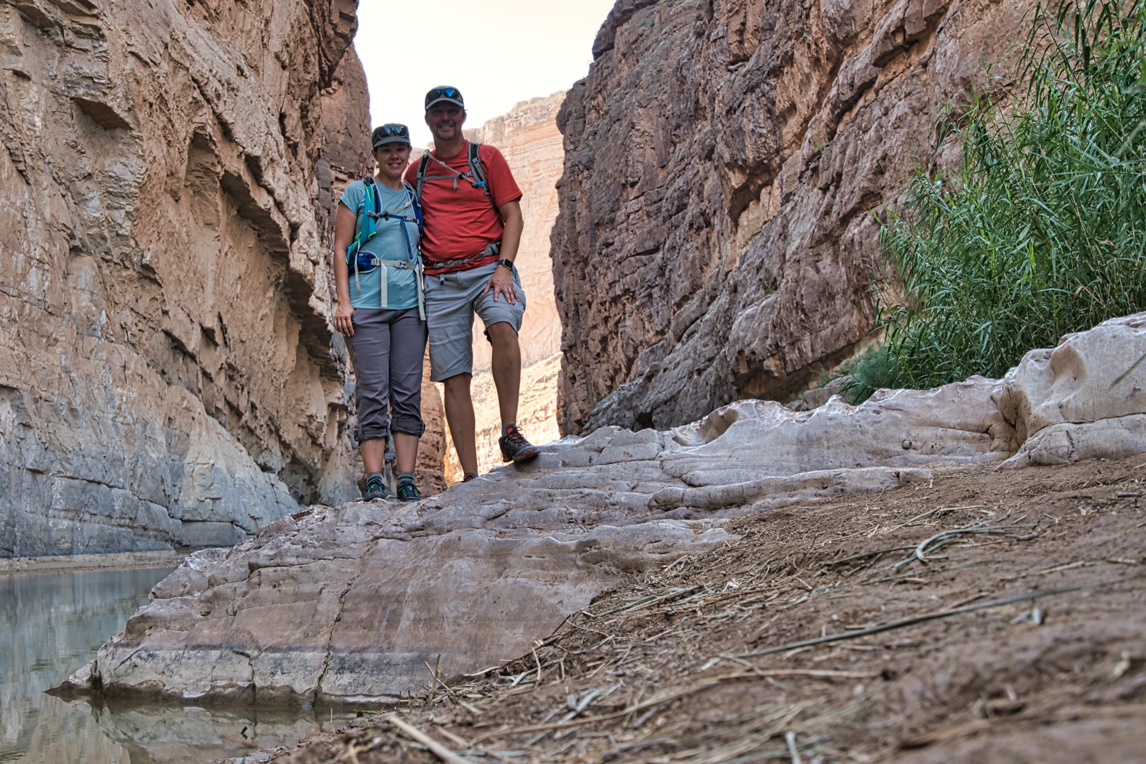
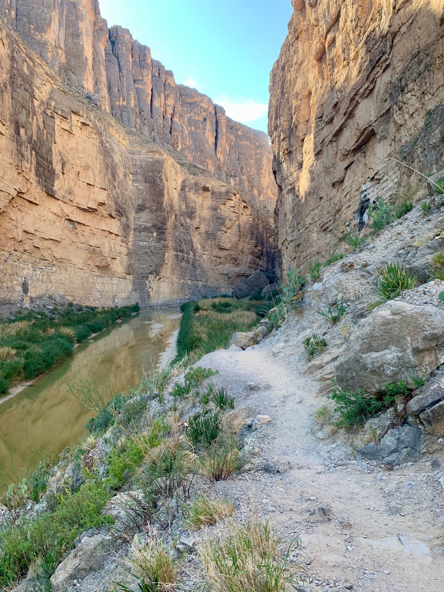
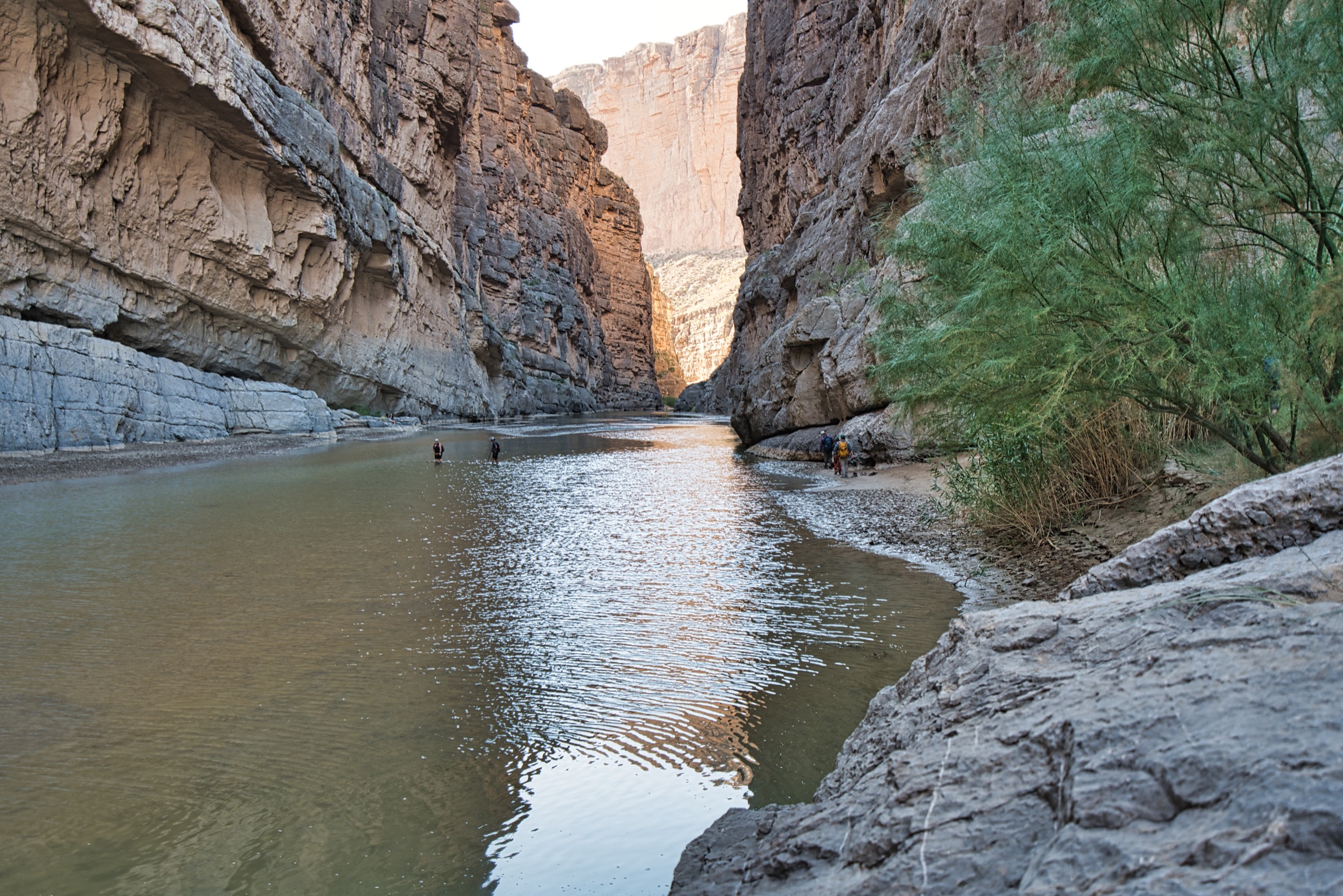

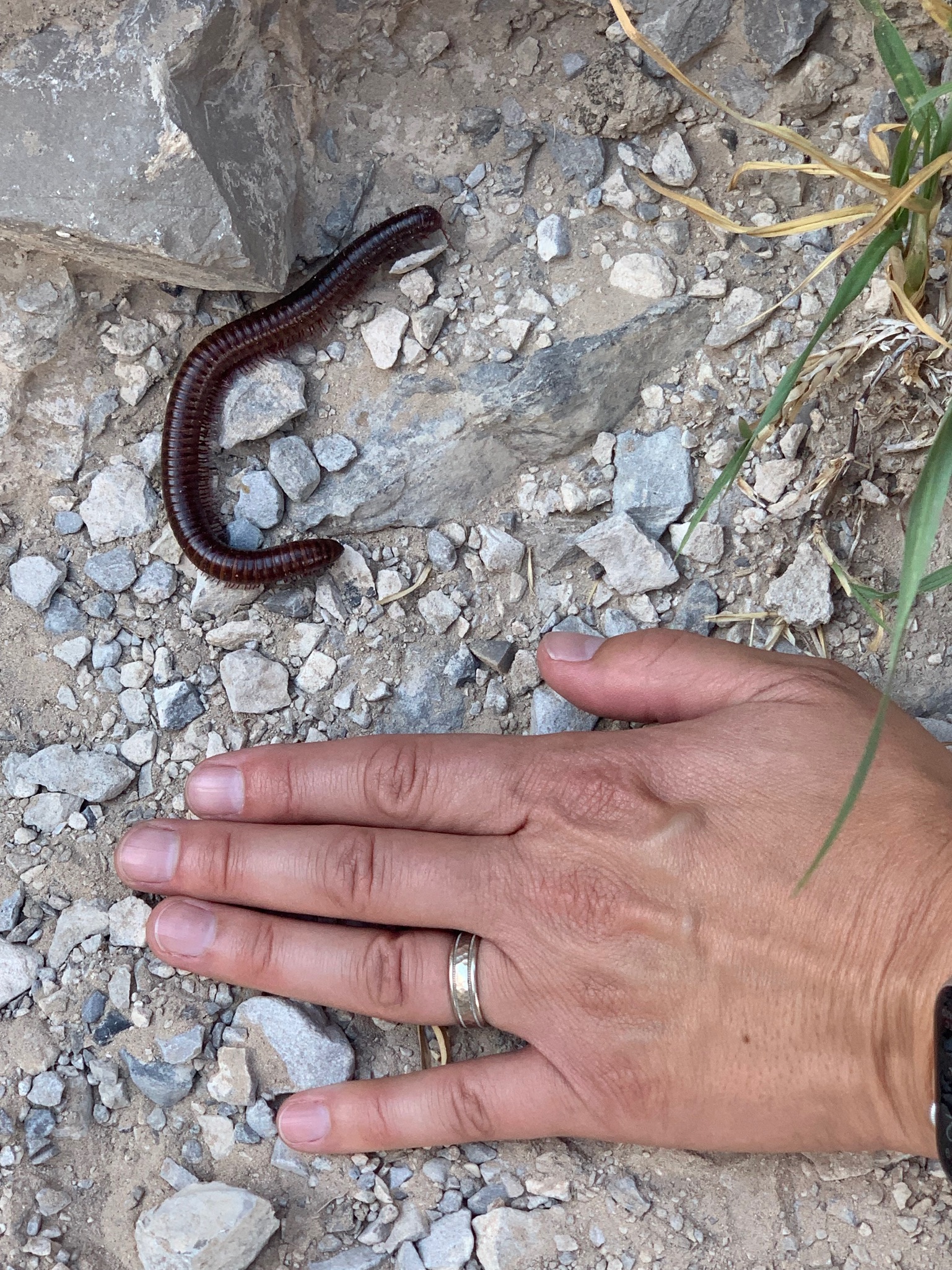
You can get permits to do a river trip by boat, but we did the 1.5 mile hike with 610 feet of elevation gain instead. In addition to the rock formation, we also saw a few millipedes and big horn sheep across the canyon, though we didn’t get a good picture of the sheep, unfortunately. As you rise and descend the rocky trail, the temperature and light conditions fluctuate noticeably. The views of the surrounding area are stunning from the topmost part of the trail, and it’s not at all scary. It’s a must-see if you make it down to the southwestern part of the park.

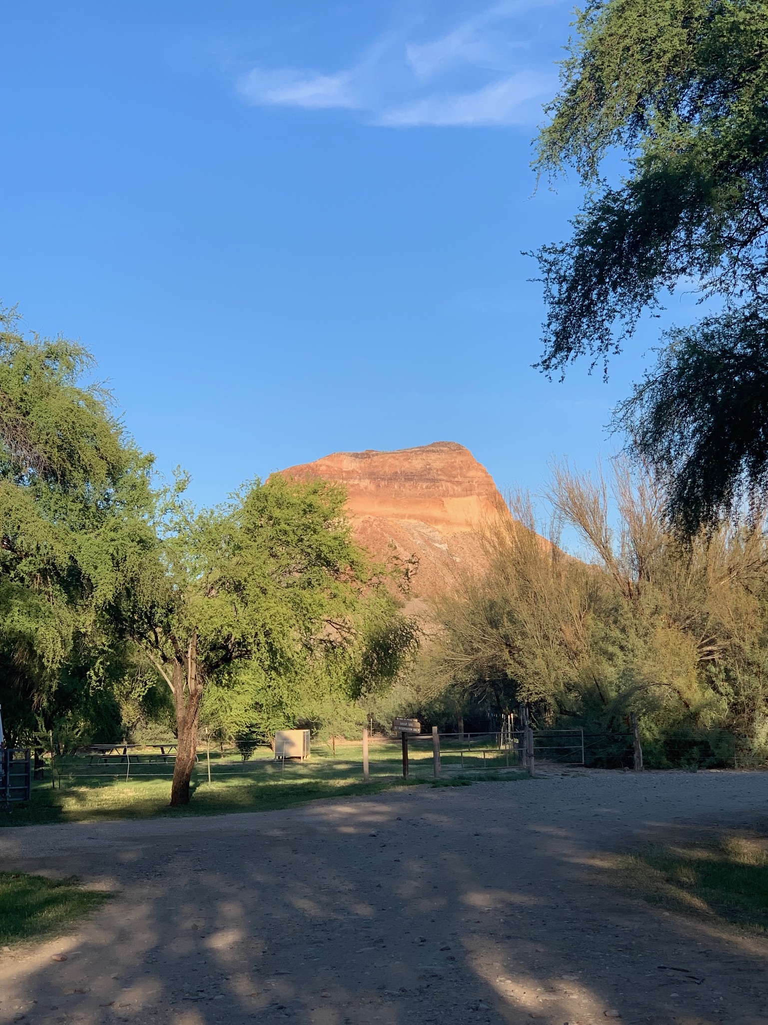
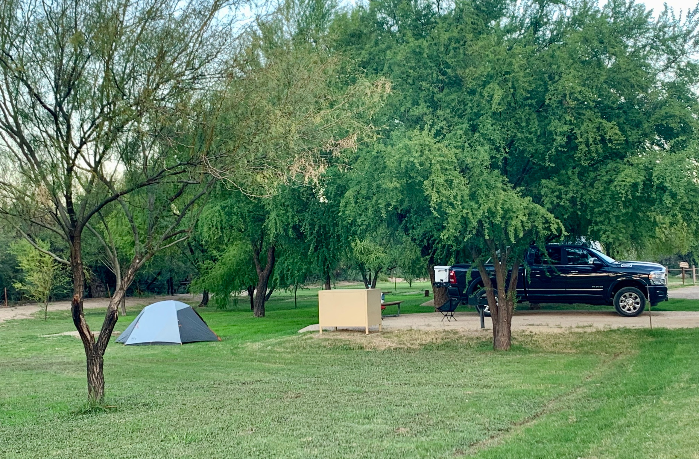
Cottonwood Campground:
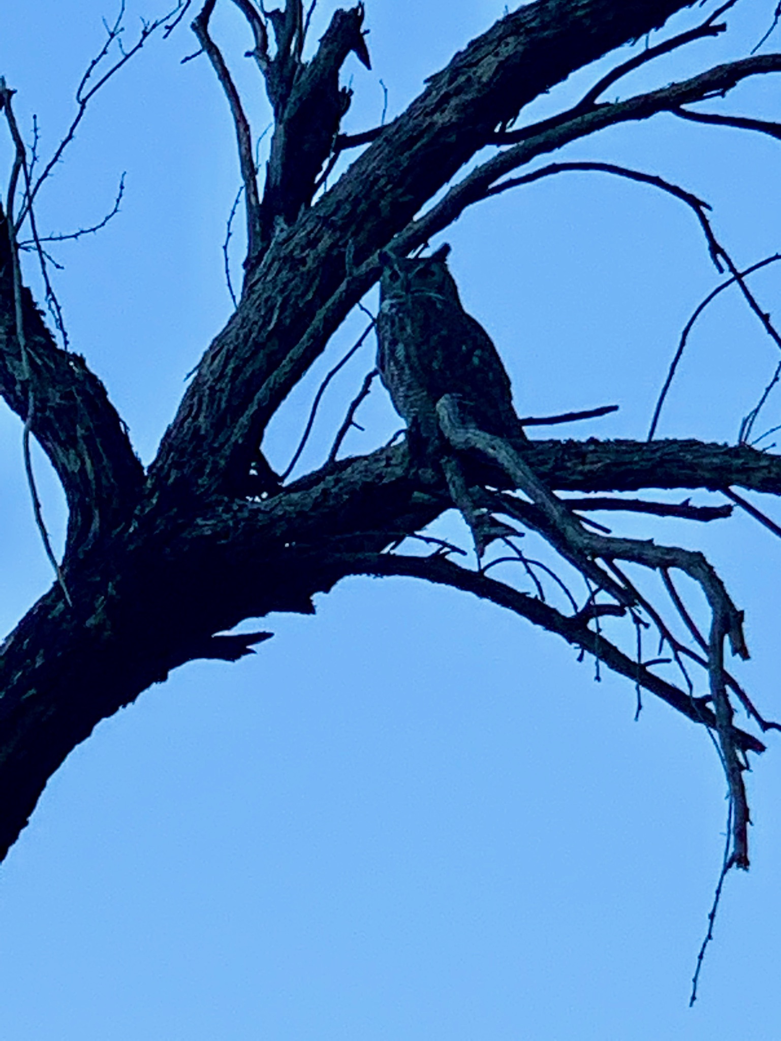
Down in the southwestern portion of the park near the Santa Elena Canyon Trail is the Cottonwood Campground. It does not have a lot of frills, but they flood the area with water, so you have grassy areas to pitch a tent, fairly wide and solid parking pads for your vehicle or RV, clean pit toilets, bear boxes at every site, and centralized bear-proof trash bins. It was really quiet, the camp hosts were friendly and helpful, and we even had a a great horned owl that would visit every evening. The owl was not perturbed at all by gathering crowds of campers, so you could get fairly close to it. How cool is that?!? 🦉If you don’t mind the scant amenities, this is a great campground. Plus, they use reverse-osmosis to pull water from the Rio Grande for drinking and it tastes great!
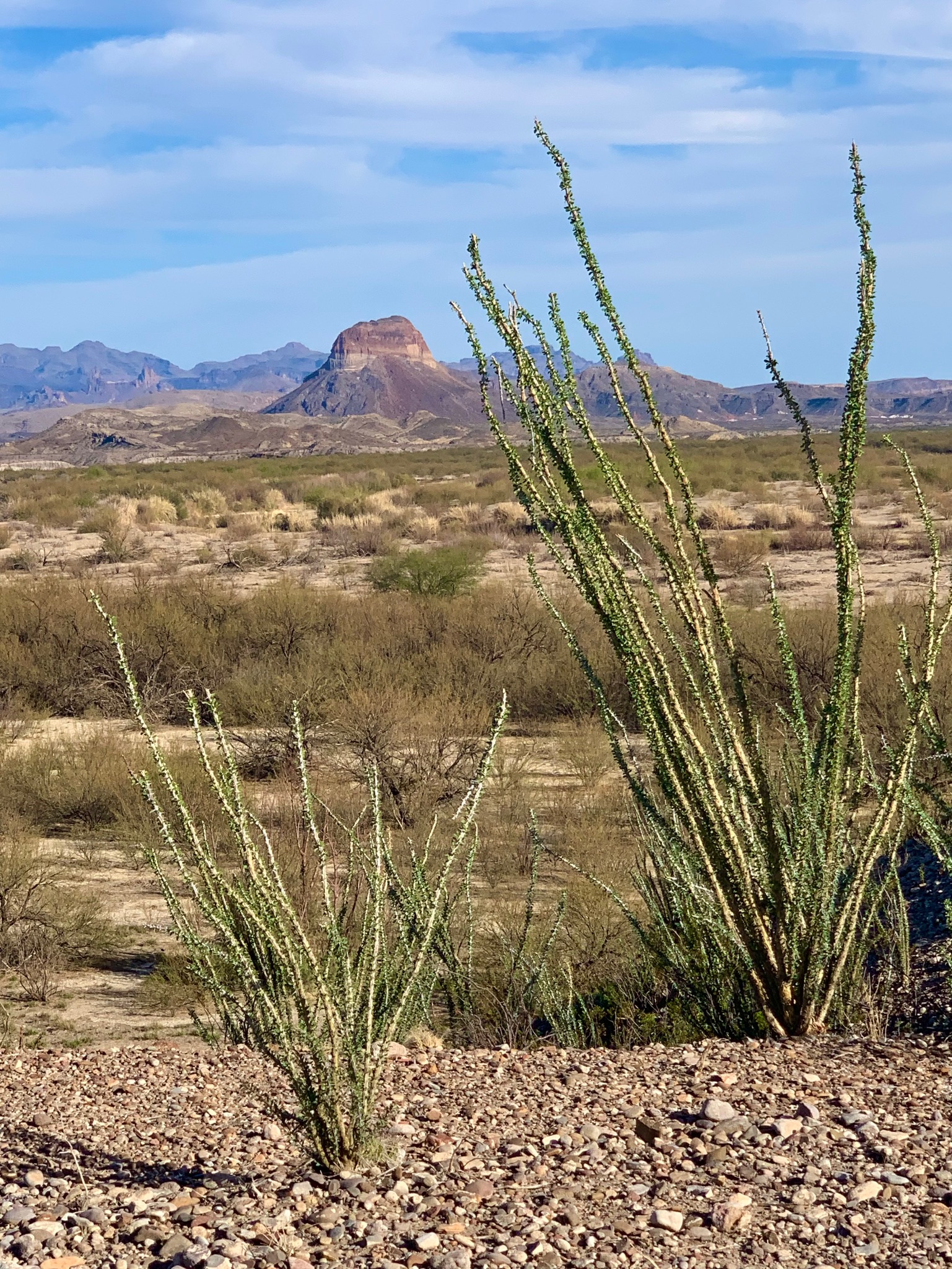
Short walks/roadside attractions: Burro Mesa Pouroff, Dorgan Sublett, and Tuff Canyon:
Not everyone is up for a big hike, so rest assured that there are plenty of roadside attractions where you can still see some nifty sites in the park without a lot of walking. The ones I outline here are all along the Ross Maxwell Scenic Drive. Please note that we visited in November, so the temperatures were more moderate. You should always wear sunscreen, protective clothing and bring plenty of water no matter how big the walk or hike.
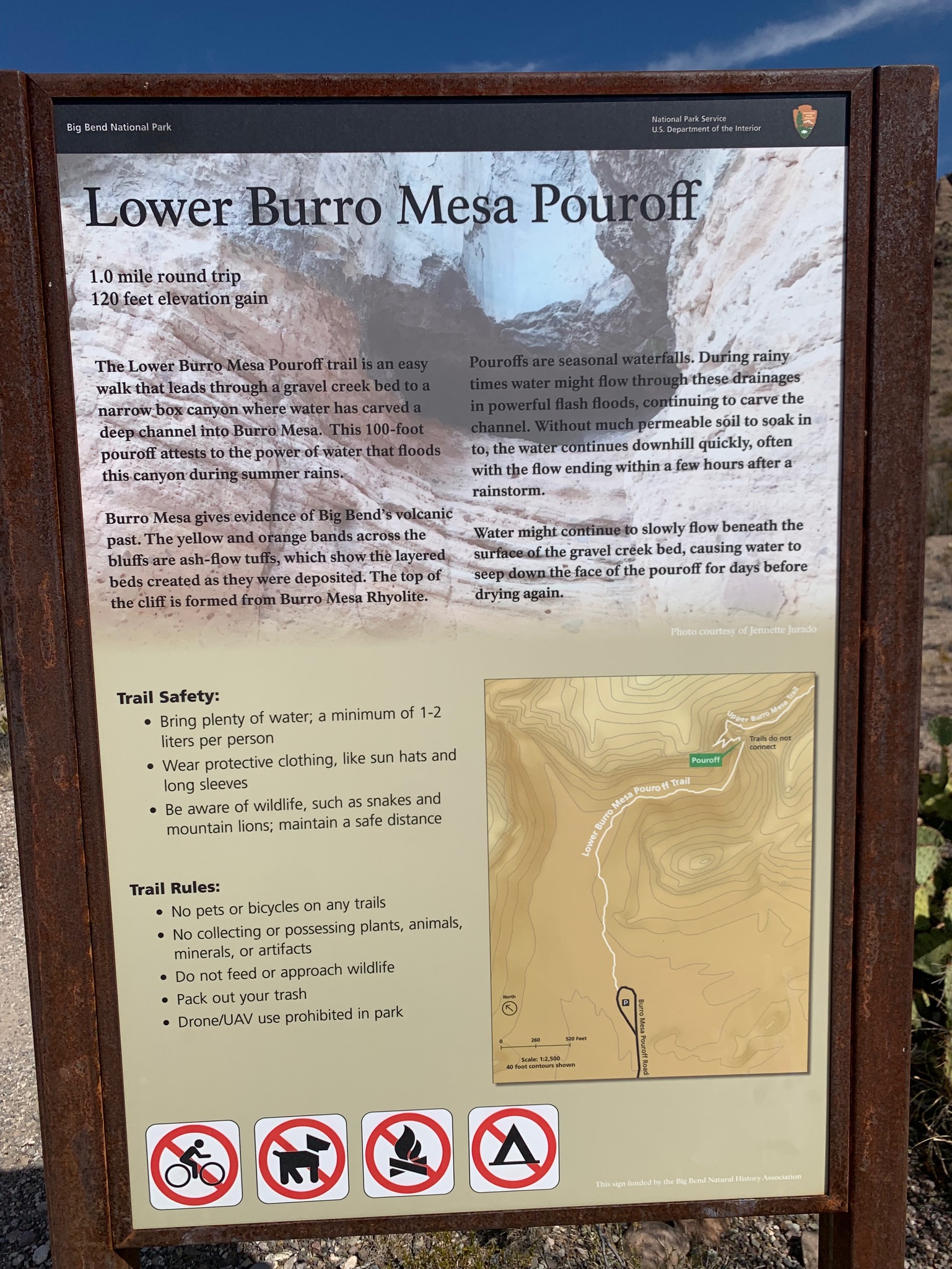
We stopped for lunch at the Burro Mesa Pouroff, which doesn’t have any facilities, but there is a short walk to the pouroff itself, which is a round trip of 1 mile and 120 feet in elevation gain. The surrounding rock formations are beautiful as well, so there are many opportunities to capture some great landscape pictures from this area.

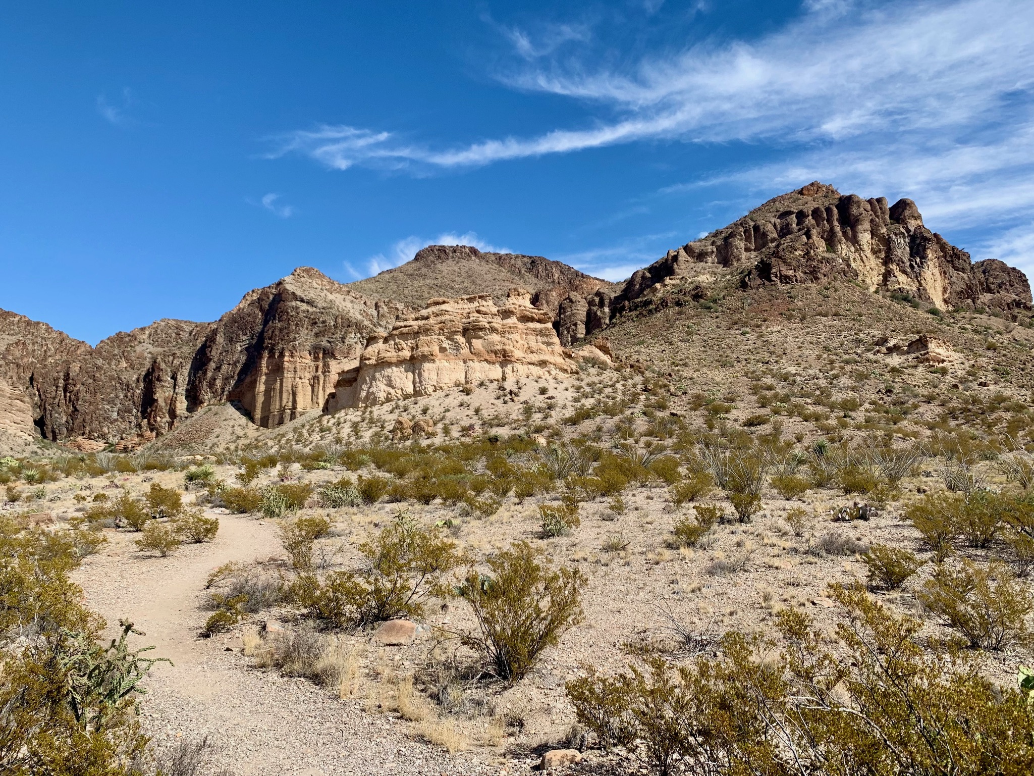

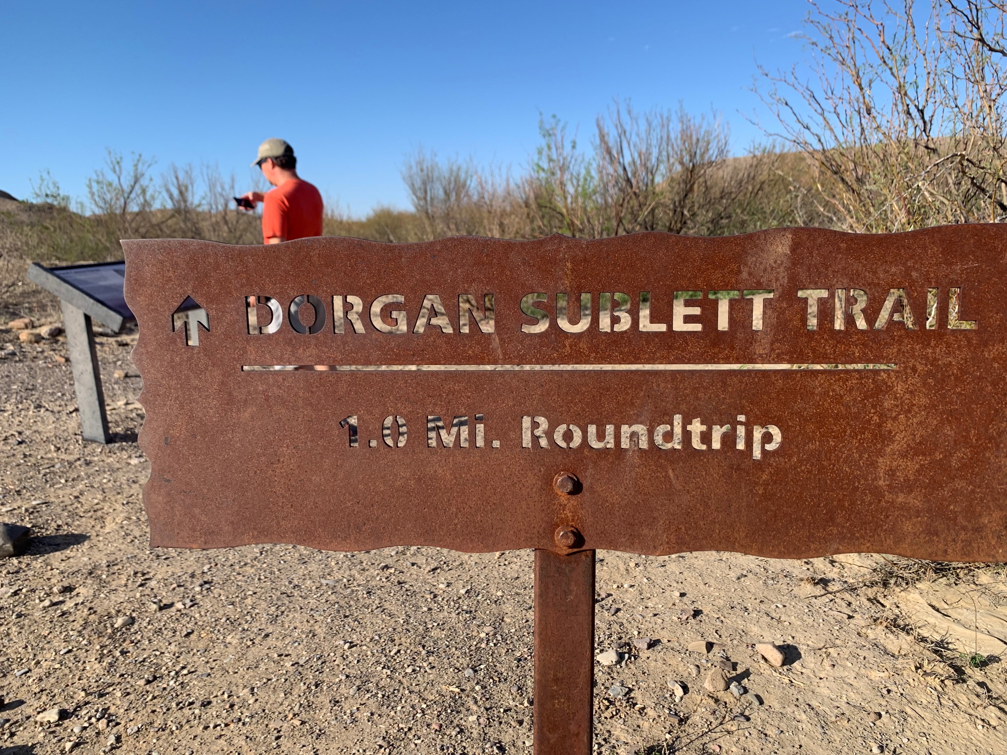
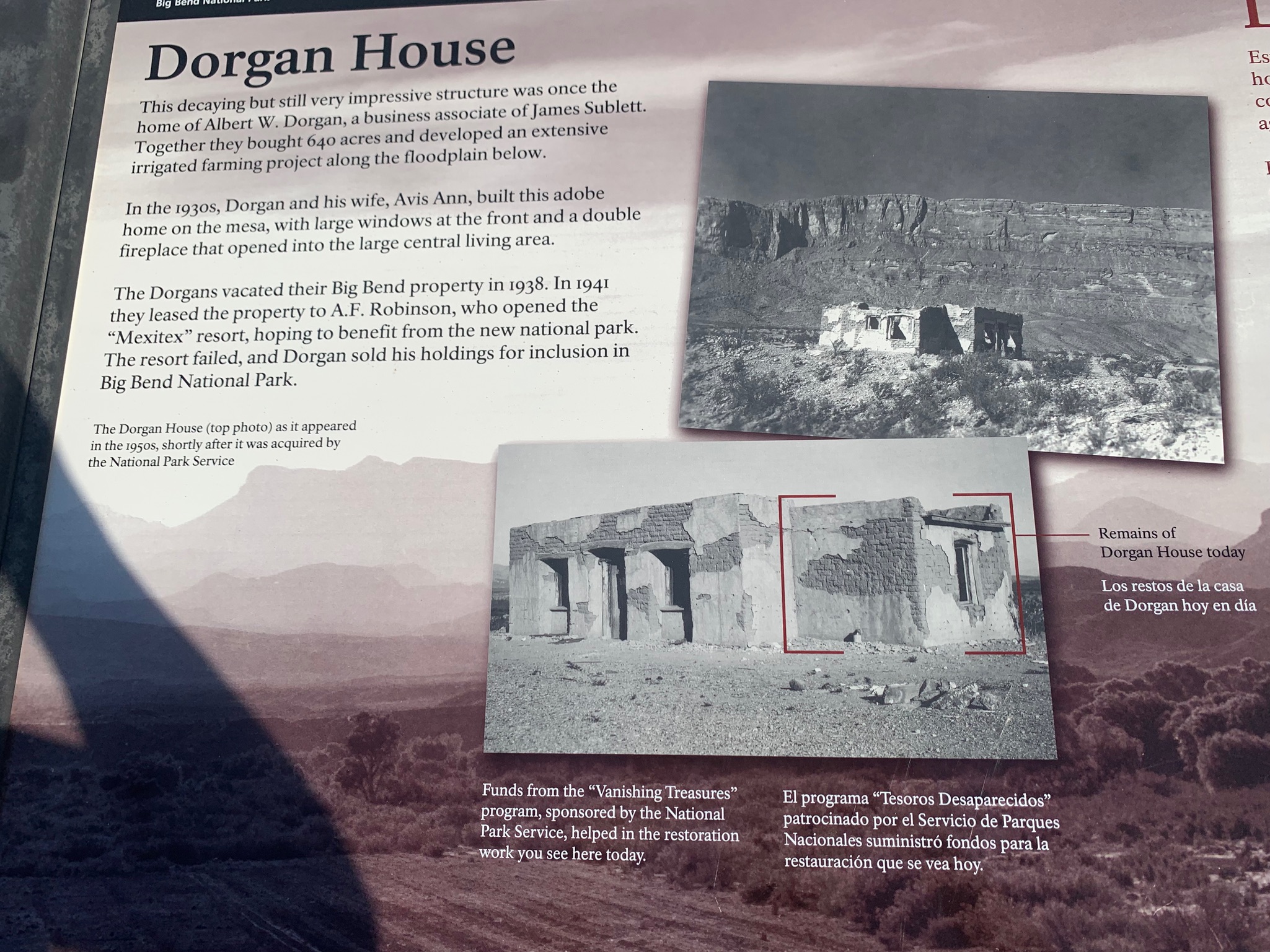
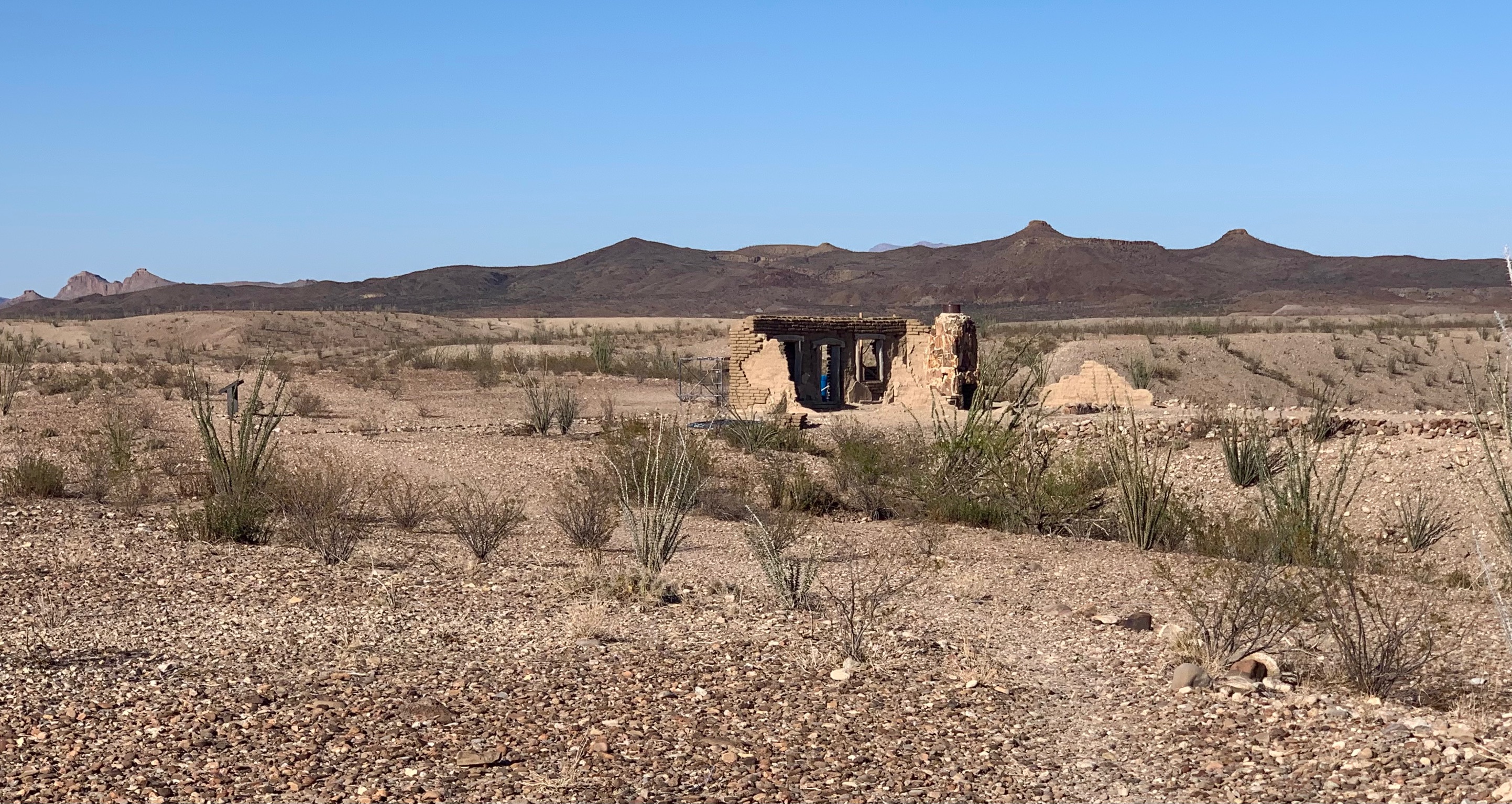
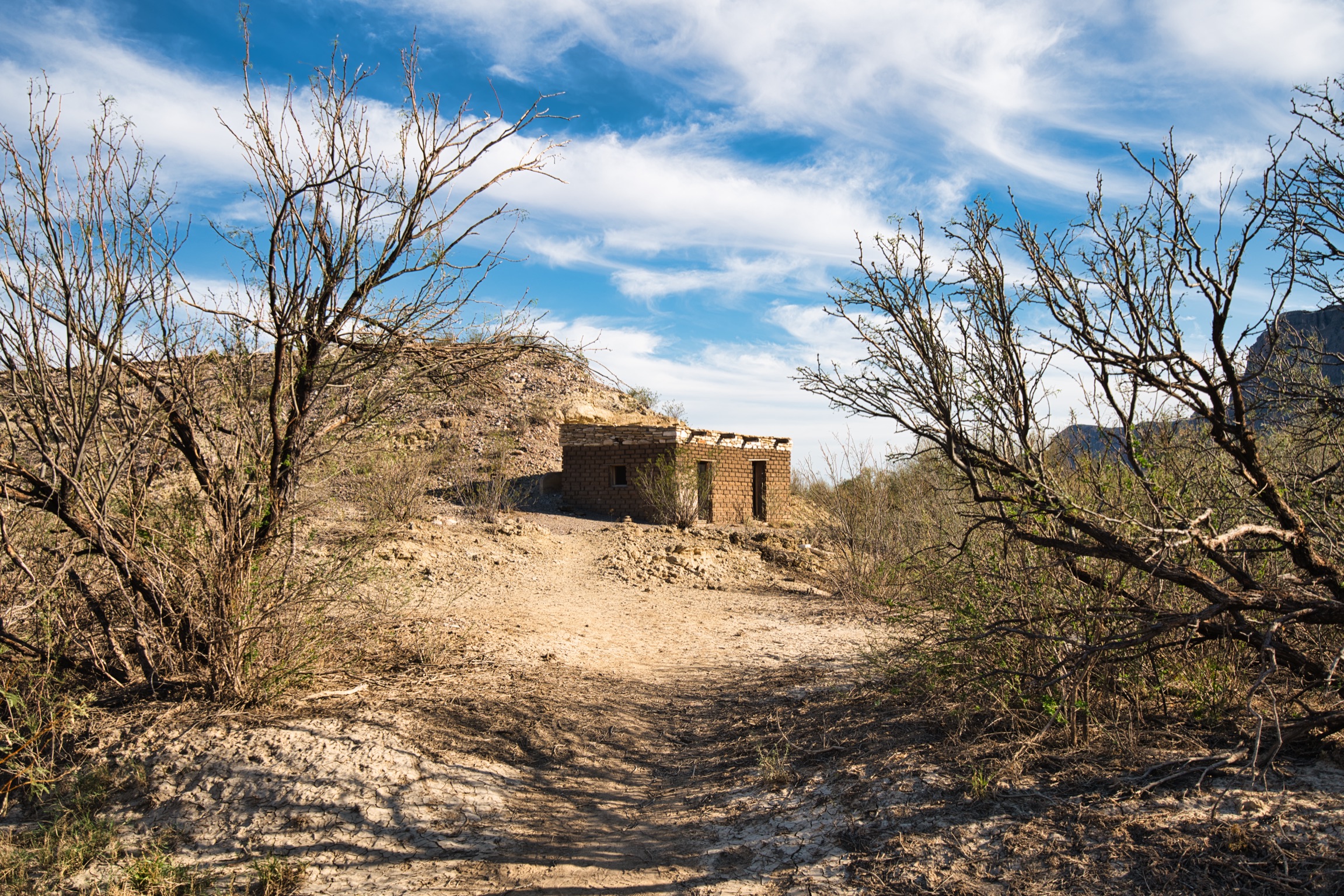
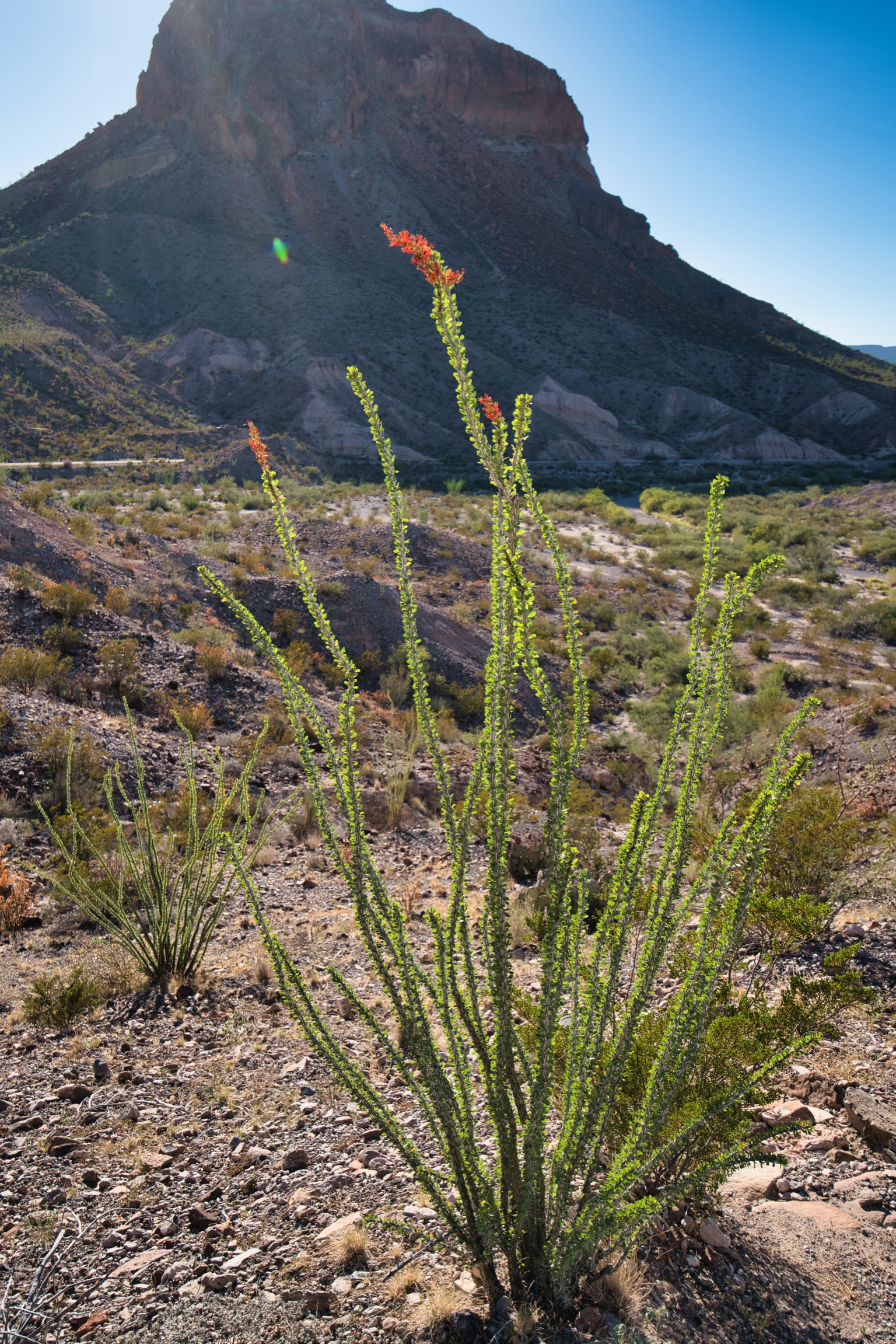
After hiking the Santa Elena Canyon Trail, we visited the Dorgan Sublett to check out the remaining structures that were built in the area, and read the plaques that outlined the history on the establishments that were there and the people that owned them. This trail is also 1 mile and just 56 feet in elevation gain. The Dorgan House was in the process of another restoration while we were there. The Sublett House, however, has long since been demolished, and all that remains is a park plaque and the house’s foundation. Views of the Cerro Castolon are stunning from here, which is a rock formation that reminds me of Bell Rock in Sedona, AZ.
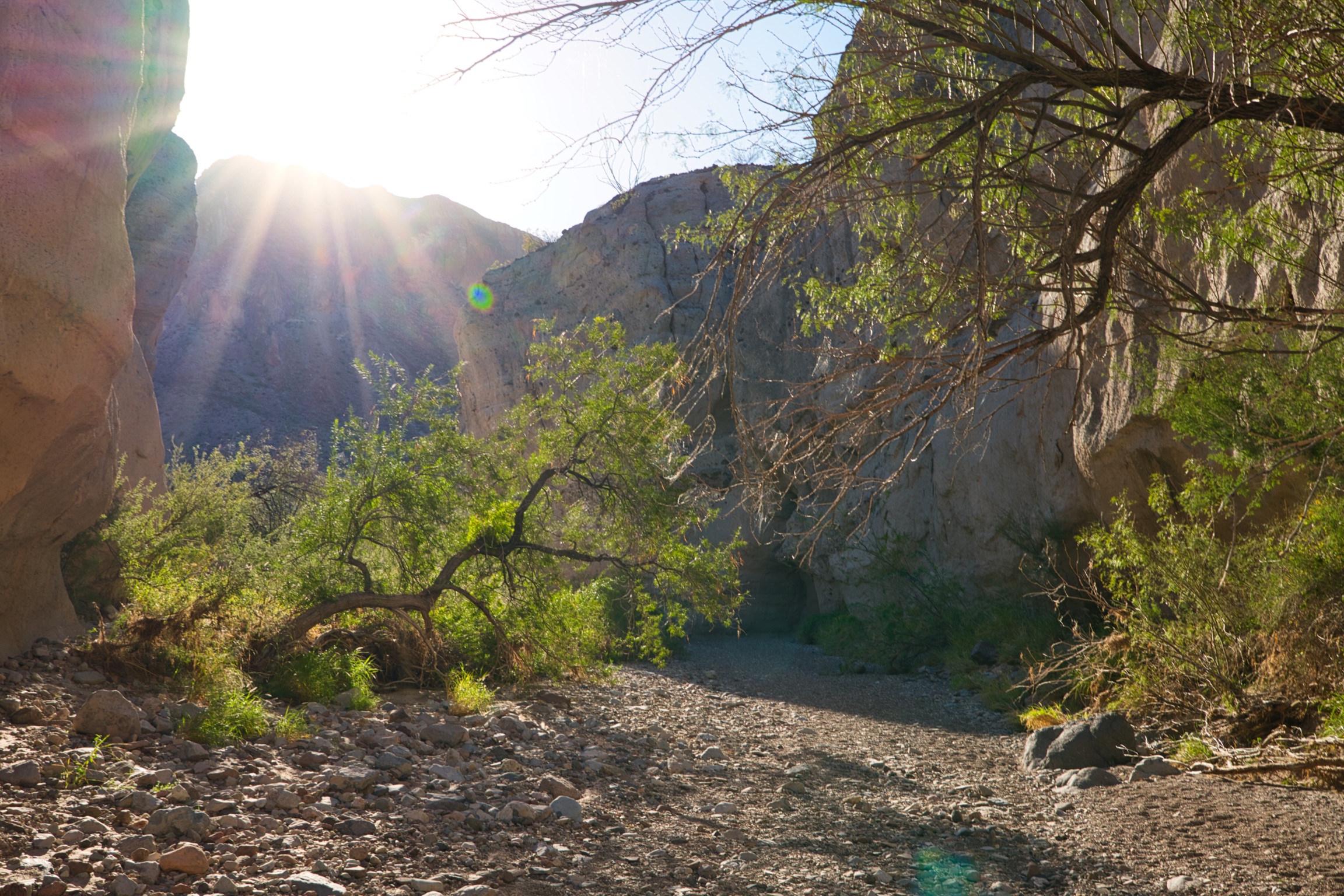
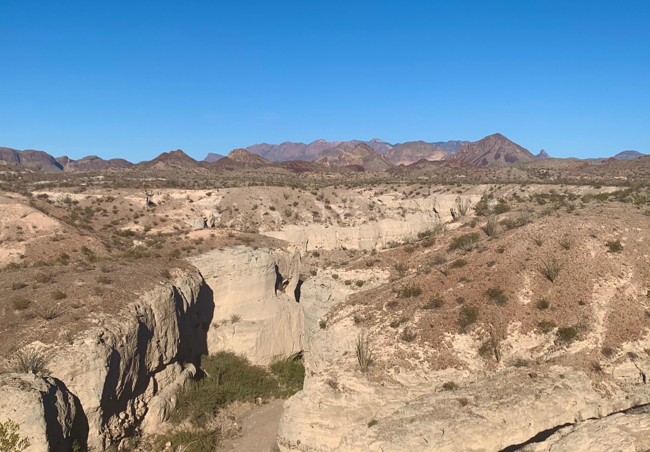
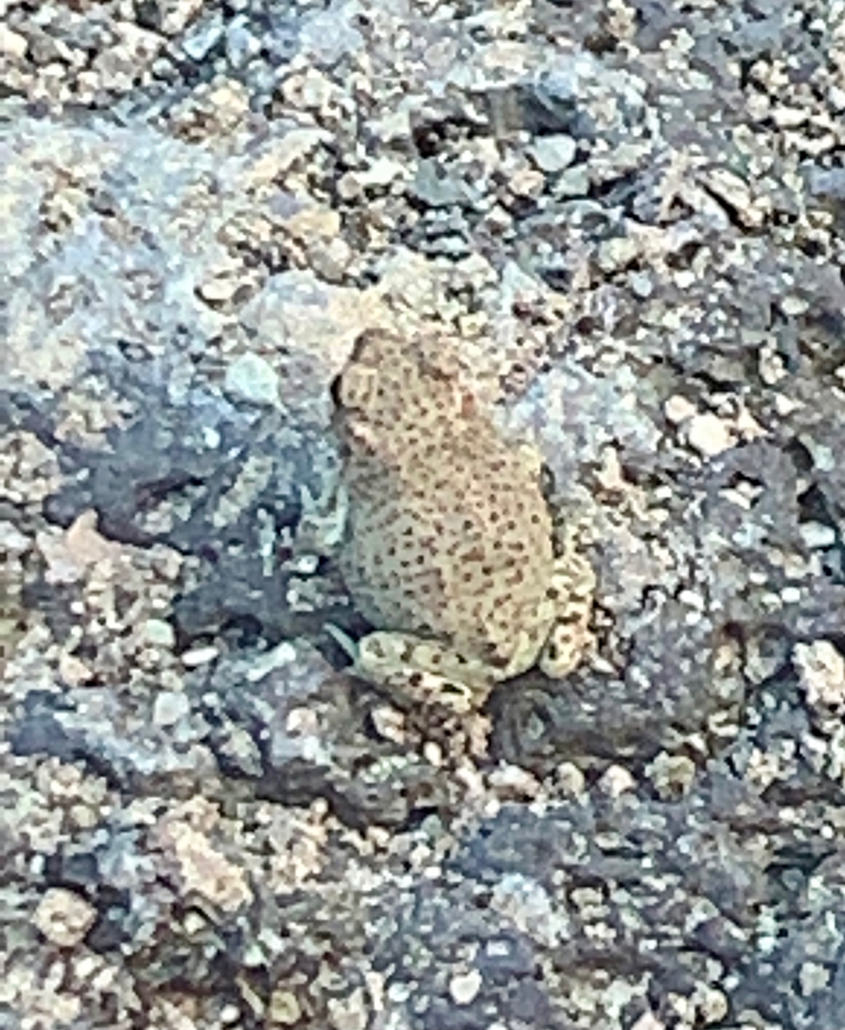
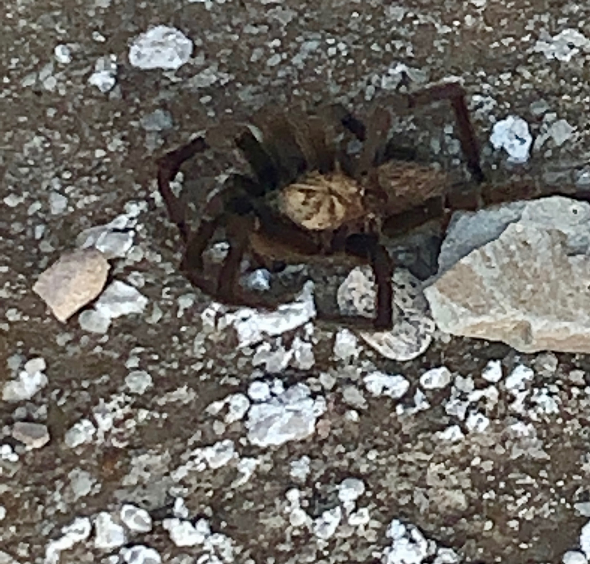
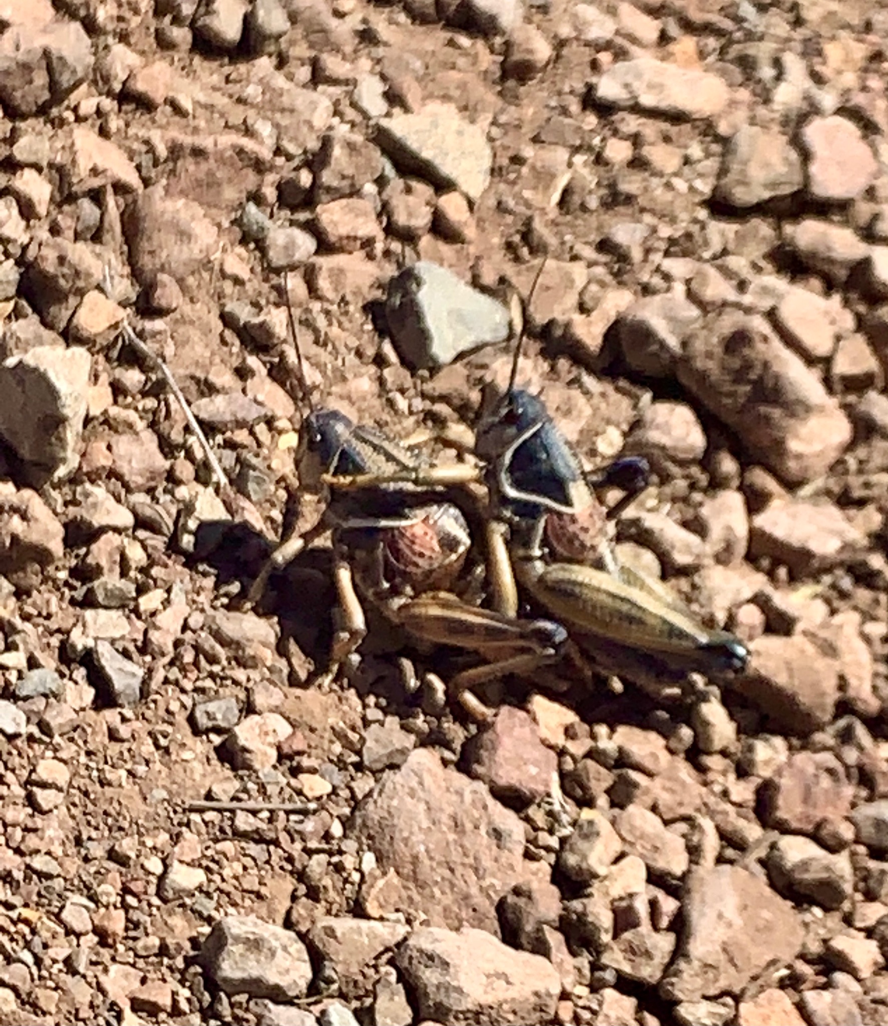
Another roadside stop called Tuff Canyon gives you the option to overlook the canyon with a few viewing places, but also to drop down into the canyon. We chose to drop into the canyon, and were rewarded with some shade, the discovery of a Texas Brown Tarantula, a common side-blotched lizard and a red-spotted toad! The toad was the biggest surprise, but there is indeed some water that collects in this canyon. From the top you get sweeping vistas of the northern mountain ranges, so it seemed like a win-win no matter which part of this attraction you explored. The trail that drops into the canyon is 3/4 of a mile round trip and 200 feet of elevation gain to get back up to the top.
Pine Canyon Trail:
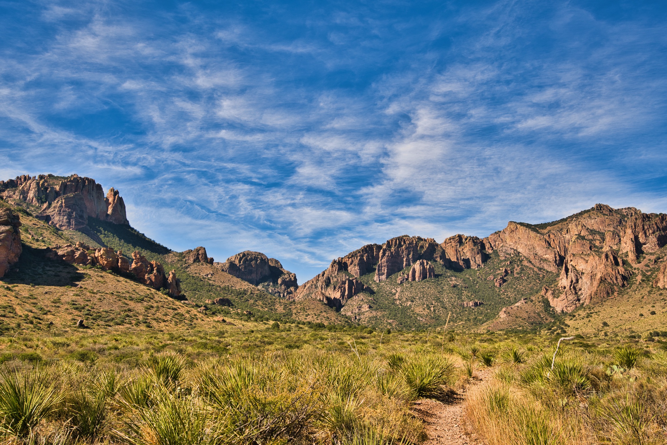
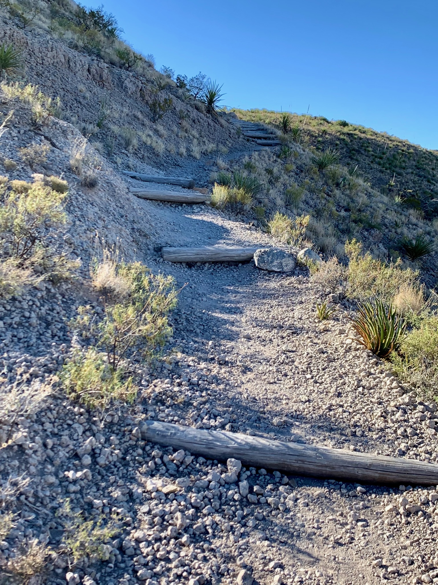
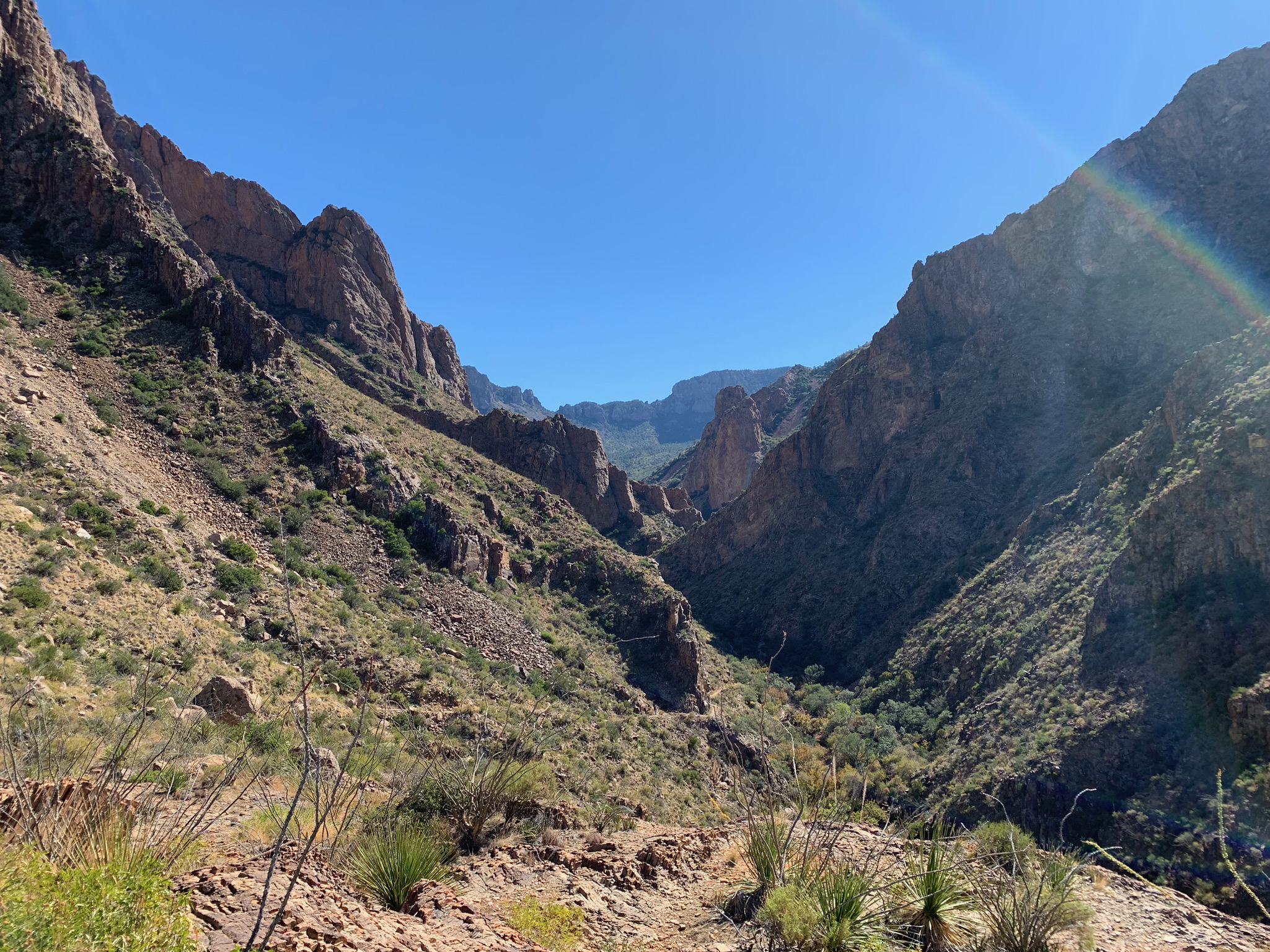
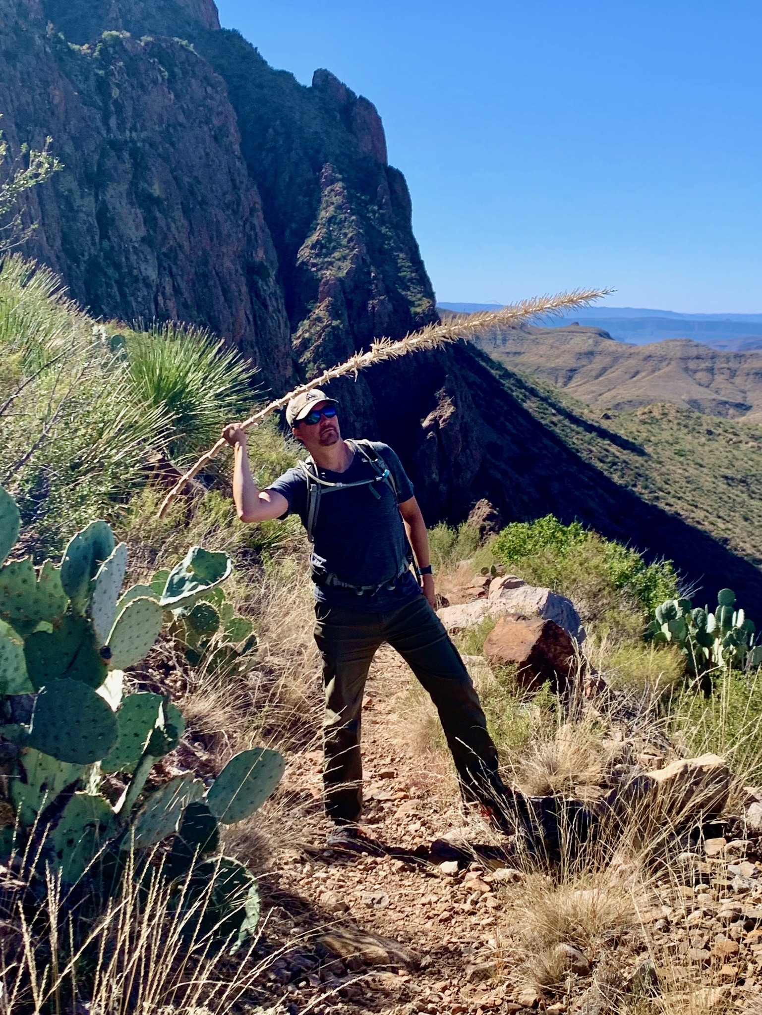
For those of you with a four-wheel drive or off-road vehicle, Pine Canyon trail is a true gem with an unexpected shady canyon toward the end. Heading east past the turn offs for Chisos Mountains and the Panther Junction, there is a dirt road named Glenn Springs Road on your right-hand side. Travel down this road for 2.3 miles and then turn right onto Pine Canyon road for another 4.1 miles. The roads are BUMPY with lots of rocks and some washed out sections, so do not attempt driving this if your vehicle doesn’t have ample ground clearance or beefy tires that can handle the punishment of large and/or sharp rocks!
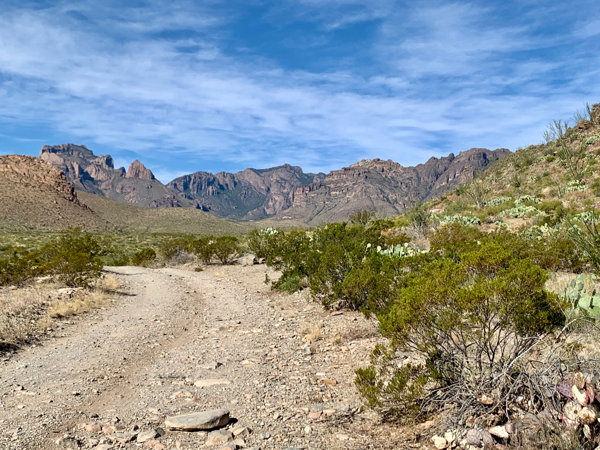
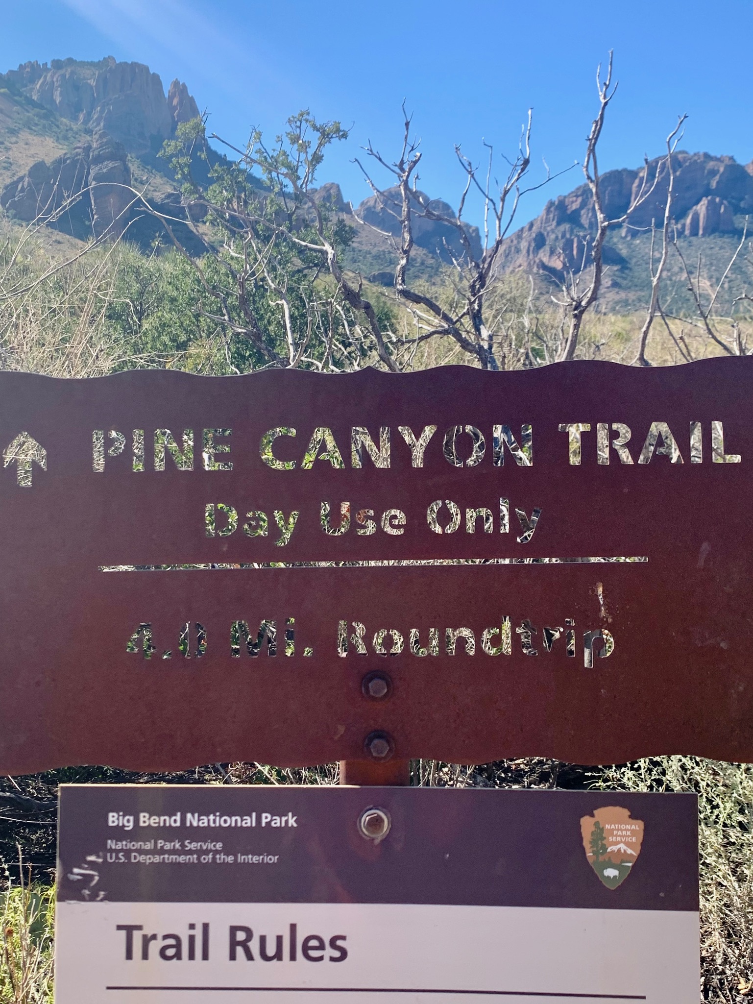
Once we arrived, the trail itself is 4 miles round trip, and about 1000 feet of elevation gain. There is a lot of sun exposure for the first 1.5 miles in, but depending on the time of day you start your hike, there are some shade breaks along the way. We were happily exploring the shaded canyon toward the end of the trail when Matt heard a noise ahead of us.
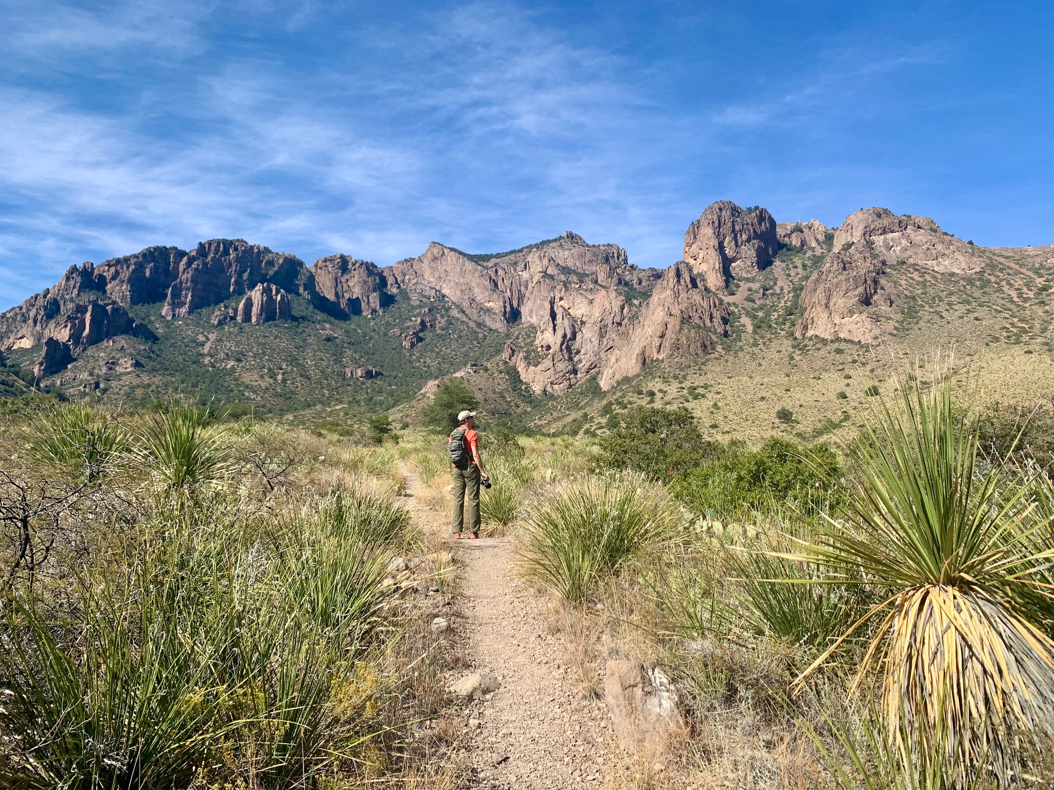
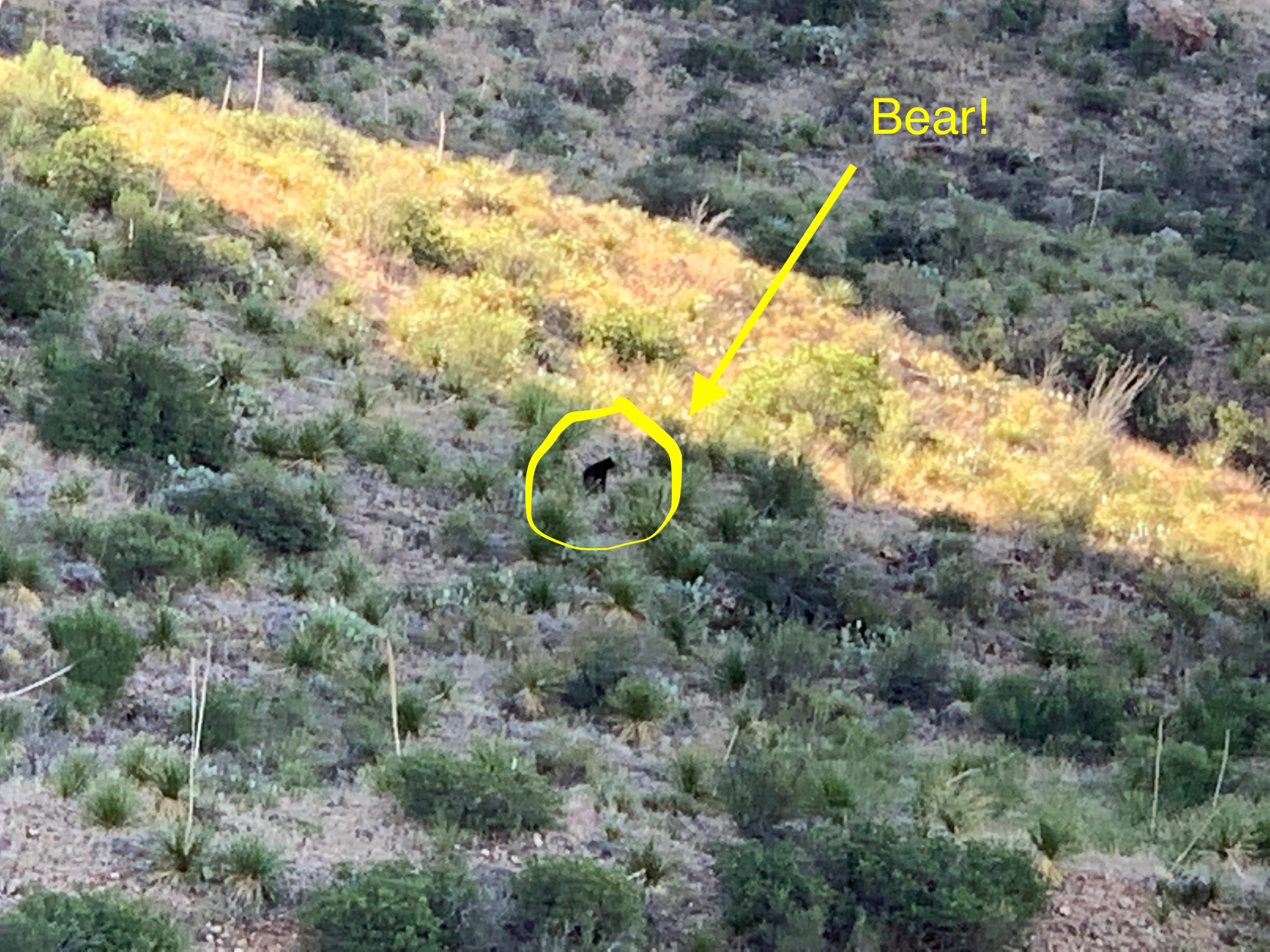
The sign at the beginning of the trail warned us that there are black bears and mountain lions in the area, so Matt immediately thought it was a bear. I brushed it off, thinking it must be something much more benign, so we decided to press onward. Matt went up the next rise in the trail and quickly shuffled backward whisper shouting at me, “Bear! Go! Bear! Go!” I did not see the bear myself, but Matt says it was a large bear that took up the the entire width of the trail and was just 15 feet ahead of him. 🐻😱 That’s a little too close for comfort, so we quickly got out of there, looking behind us to make sure the bear didn’t head our way.
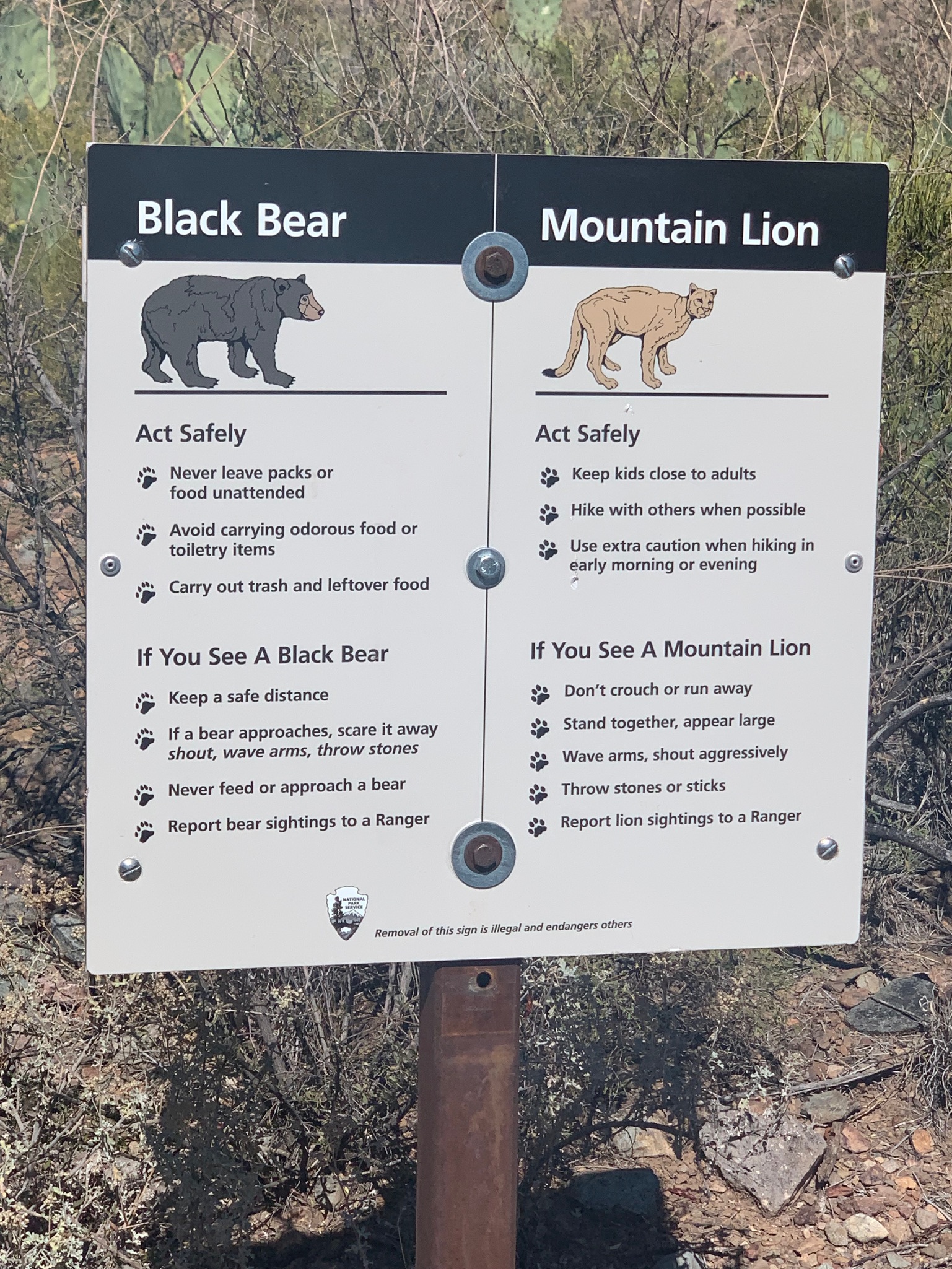

Alas, we did not get to finish this hike, but boy what a story! We stopped off at the Panther Junction visitor center and reported our siting, because apparently there are only 30-40 bears in the whole park. And, it answered my question about whether black bears were already hibernating for winter…it turns out their hibernation window is January through March because of the mild climate in Big Bend.
Cattail Falls and Oak Spring Trail to Window View:
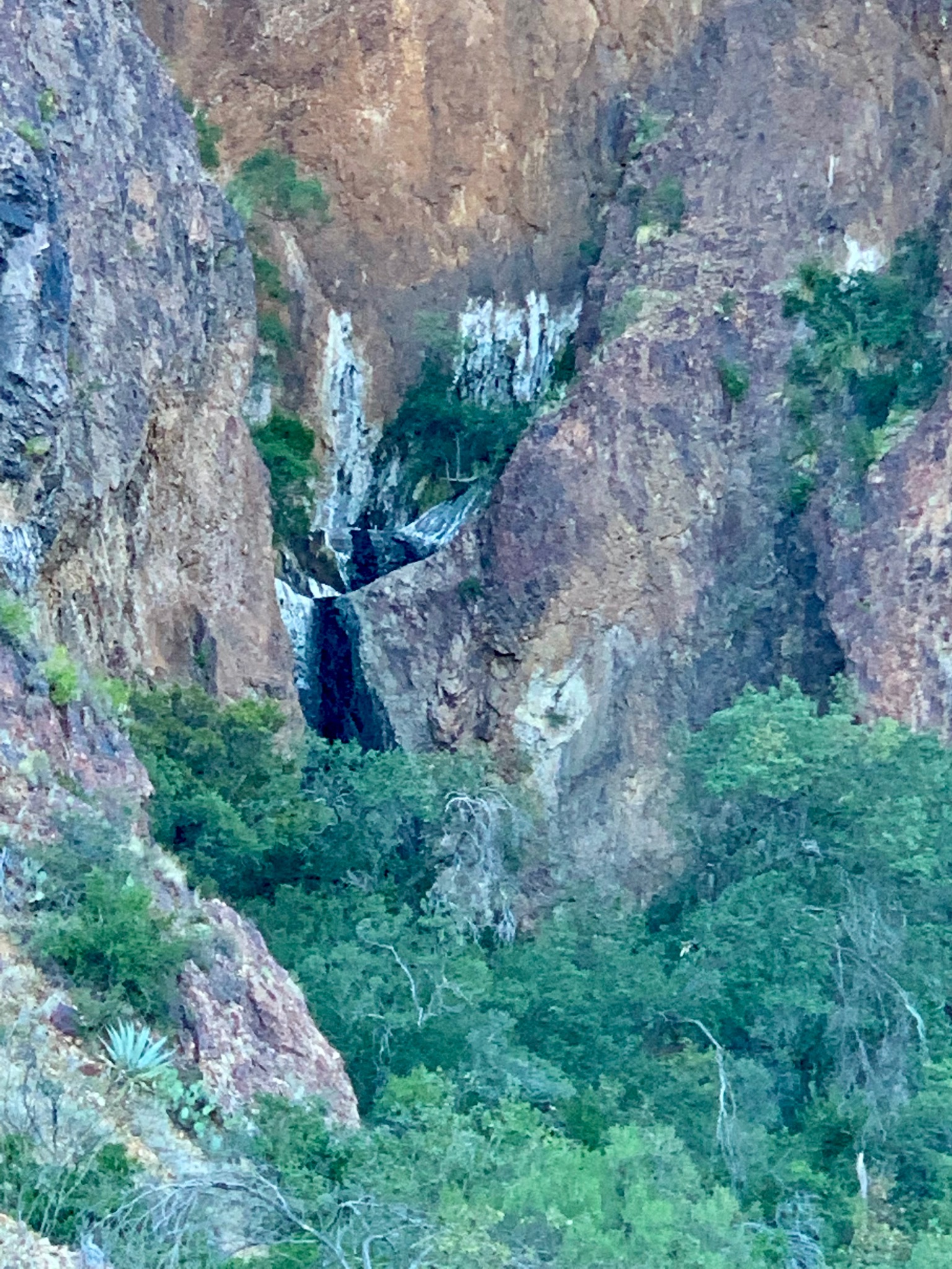
Another neat trail that you might like is Cattail Falls. You can drive in for a little ways on one of the service roads, but will end up walking for a few miles on more service roads before you reach a little creek and signs for the Cattail Falls. From the Ross Maxwell Scenic Drive road, it’s 5.6 miles round trip and 685 feet of elevation gain. The Cattail Falls are just a mile farther from the creek.
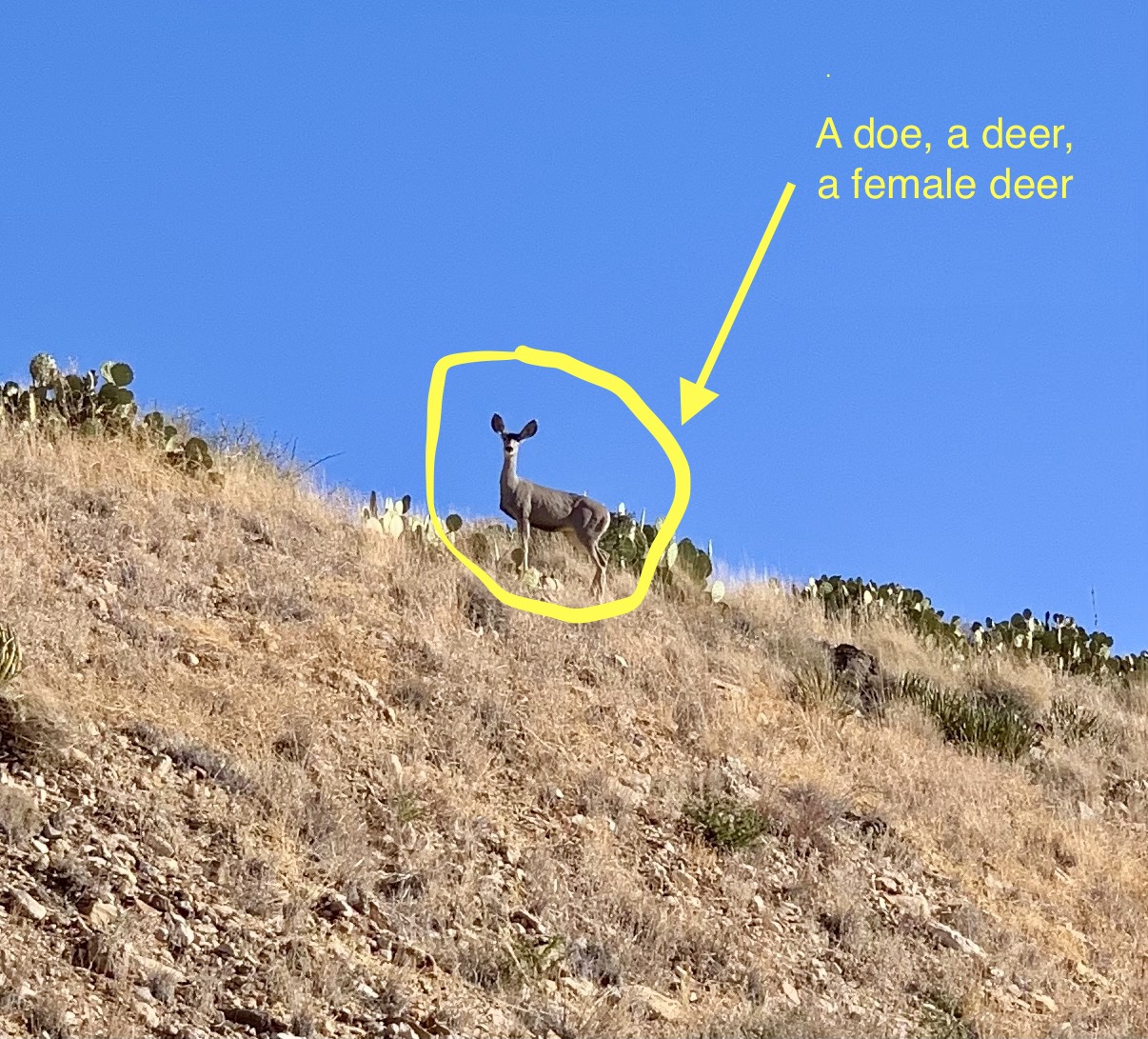
We arrived relatively early in the day, so it wasn’t very hot yet, and we saw a doe and two fawns on the service road. We quickly moved on so we didn’t upset her…I’ve done that inadvertently in the past and it did NOT turn out well! We were about a tenth of a mile from the end of the hike when I saw this black speck across the ravine from us. Matt got out the binoculars and lo and behold, it was another black bear!
This time we got to enjoy our observation from afar, but as we continued toward the falls, the black bear started heading in the same direction, and the ravines meet at the falls. We didn’t want another close encounter, so we decided to head back. Foiled again! I did get some great snapshots of the sun starting to peak on the horizon of the Chisos Mountains, but was bummed that we still had yet to complete one of our hikes.
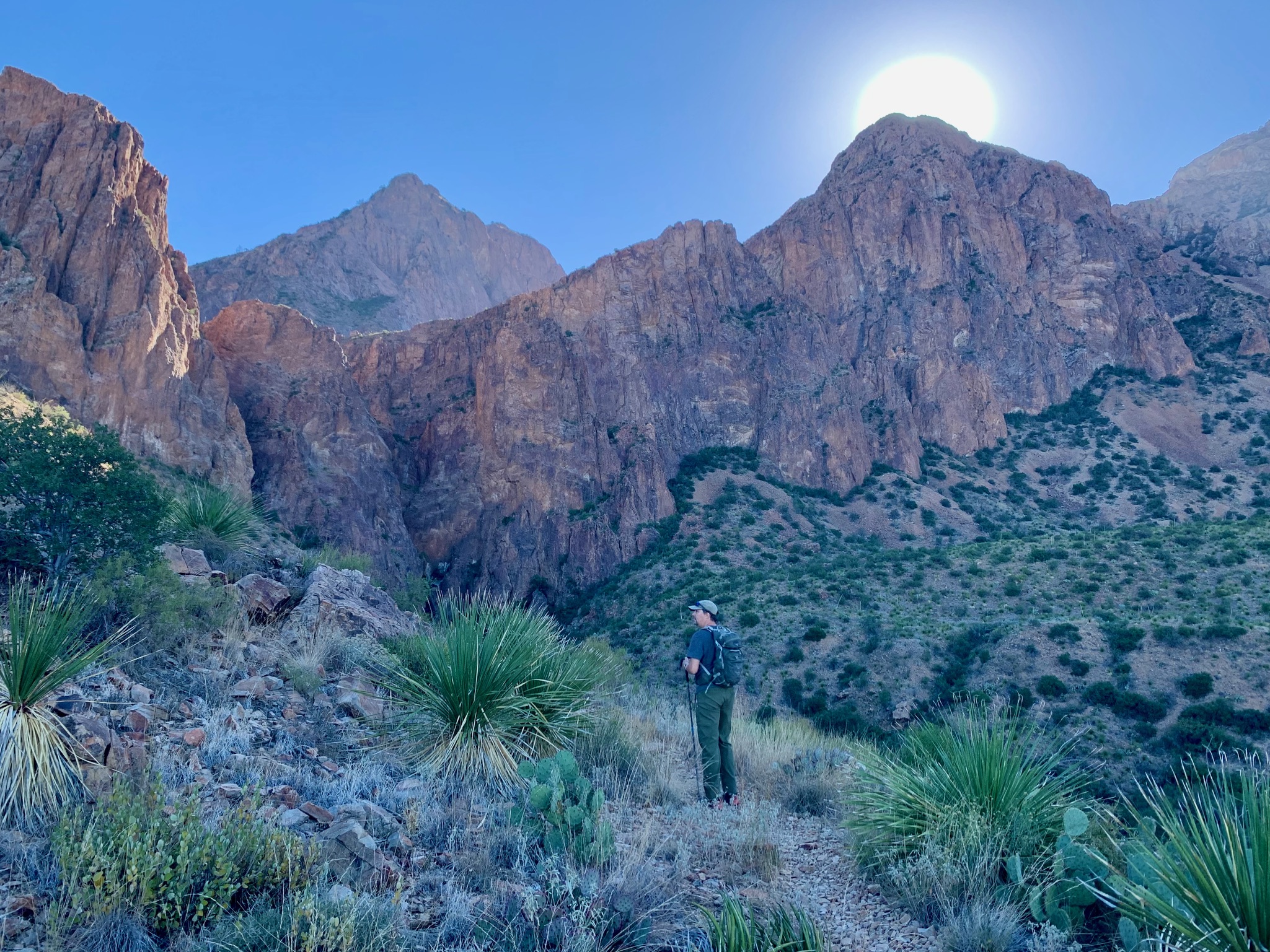
When we got to the shaded creek, I convinced Matt to go in the opposite direction of Cattail Falls on the Oak Spring Trail to reach the junction with the Window Trail. It was a real butt kicker of a climb, but we enjoyed spectacular views of the canyon within the Chisos Mountains and had the trail all to ourselves. Most people approach from the other side of the canyon for the Window View. This trail added 3 miles and about 1000 feet in elevation gain to our hike, but it was worth it!


It was pretty darn hot by the time we headed back out on the service roads, but a wide-brimmed hat, sunscreen and plenty of water were our friends. I was shocked at how many people were just starting to head in during the midday sun. Hopefully they came prepared! 😬
DB’s Rustic Iron BBQ, Terlingua, TX:
The Cottonwood General Store is just south of the turnoff for Terlingua, Texas, which is a revitalized ghost town in West Texas. We did not have a lot of energy at this point, so decided to hunt for some food nearby. We found DB’s BBQ, and enjoyed some of the best brisket and pulled pork. Yum! It was another spendy meal with all of that inflation going around, but the meal did come with sides, so we got beans, slaw, and potato salad.

We were still so tired afterward, that we didn’t have much energy to motivate ourselves to explore the town itself. 😕 We knew we still had a long drive ahead of us to get back to Alpine, so chose to just head back. BUT, we heard great things about this quirky town, so if you get a chance to visit, please reply in the comments and let me know what you discovered.
We loved our visit to Big Bend National Park and we could come back again and still have plenty to see. I highly recommend this beautiful, hidden gem in Texas and encourage you to visit. This place has rich history, expansive and varied landscapes, and is also home to a port of entry to Mexico and the nearby town of Boquillas. We were one week too early to take advantage of the opportunity to visit this nearby village, but here is one person’s description of their encounter to give you an idea of what it was like.
Thank you to our friend Tali for sharing her trail suggestions with us. We would not have had as much excitement on our hikes without her sharing the Pine Canyon and Cattail Falls hiking ideas. 😂 We are heading up to Kansas to visit family, so I will share our experience driving the 1100+ miles up there very soon. Cheers all!

We love Big Bend too! We stayed across the road from Cottonwood General Store, so we’re very familiar with what an awesome store it is! Once again, your photos are spectacular. Sorry two of your hikes were interrupted by bears!
LikeLike