Although our plans changed a few times already both on the way down and since we have been here, we have managed to get out and about in the area and enjoy some of the sights.
Jackson/Moose/Grand Tetons National Park:
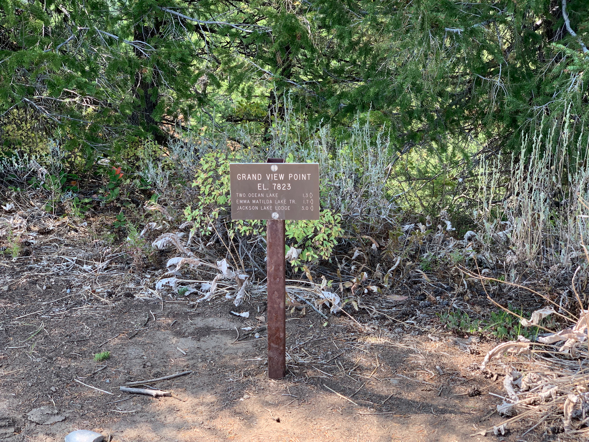
Grand View Point Trail:
In the northern part of the Grand Tetons National Park away from most of the crowds of people, we found a moderate hike called Grand View Point Trail. According to All Trails, this hike is 5.1 miles and 1368 feet of elevation gain, taking you up to a nice viewpoint of the mountains and nearby lakes, down near Two Ocean Lake, and back. You get a hefty climb each way and it is a lightly trafficked trail. There is ample parking, even a few spots designated for RV/travel trailers, but there are NO bathrooms at the trailhead, just FYI.


When we made it down to the loop that circles the lake, we ended up talking to a nice couple from Wisconsin who have been coming back to the Tetons for decades…if I’m not mistaken, around 50 years! They informed us that we would still need to hike for quite a while to get to a view point along the lake, so we decided to “call it” and head back up to the view point. The day we hiked was a bit on the hazy side, but on a clear day you can get a really spectacular view. If you are looking for a short but mighty hike with a view and to avoid large swaths of people as well, you might like to check this one out.
Bike paths to Jackson, Moose, Teton Village and Jenny Lake:
I managed to find a few resources for local bike paths that extend from Jackson all the way up to Jenny Lake, which sounded like a nice way to get around the area and see the national park without having to get in line with all of the cars. Our initial plan was to park at the visitor center in Moose, bike down Moose-Wilson Rd through Teton Village to Jackson for lunch and circle back up counter-clockwise on the bike path that parallels highway 191/89/26. However, Moose-Wilson Rd was closed due to bear activity, so we traveled south to Jackson and back on the same bike path.

It was super windy, but we were fortunate to face the headwind on the way down and have it push us back up to Moose! I’d rather face the headwind early than fight it all the way back when I’m more tired! Overall, the path was pretty nice and seems to get a decent amount of bike traffic, which is good to see given I’m an avid cyclist. Navigating through Jackson is a bit harder, so definitely take a look at the Jackson pathways map before biking that way, as there are heavily trafficked routes that go through town without room for bikes. Overall, if you’re looking for a relatively flat bike ride through the park, I recommend these pathways.
Dubois and the surrounding area:
Dubois Badlands Trail:
First off, yes, there are maps of the Badlands you can download from All Trails, but frankly there are so many criss cross trails throughout this public land that the map didn’t really help us that much. We were way “off trail” at several points, but it is fairly wide open, so it’s easy to figure out how to get back. I say, just wander and create your own route. There are many to choose from…it’s a choose your own adventure kind of place!
After spending so much time in mountain regions, it was neat to check out an area of high desert with such beautiful rock formations, colors, and desert flora and fauna. Because Dubois had recently had some heavy rains, my favorite parts of hike were smelling the fragrant sage and blooming flowers wafted my way off the breezy hills and seeing my first reptile in a long time! We saw a Greater Short-horned Lizard, which was really cute and patient with us as we picked it up to inspect it before safely returning it to its habitat.


On the way back we met a couple that lives in the area…the husband used to live in Jackson and moved out to Dubois to get away from the “madness” that has become Jackson with its booming tourism, etc. They recommended checking out more of the badlands that backed up to our RV park. Overall, if you like to explore without any set path, you might like this area. Just watch out for high winds. It gets pretty gusty as the afternoon rolls around. Hang onto your hat and wear some sunscreen and you should have a fun time. 🌞
This hike was one of our all time favorites, offering a little bit of nearly everything in such a short out and back at around 5.25 miles and a little over 1300 feet of elevation gain. Even the drive in was really enjoyable. Get ready for lots of photos and videos!
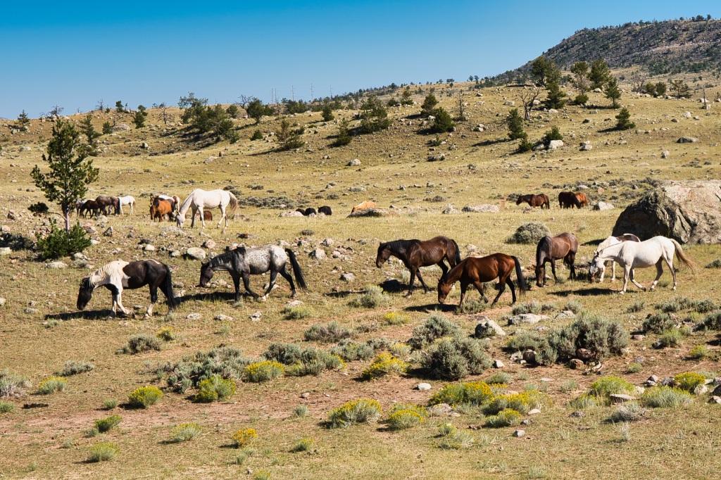
Once you turn south from Highway 26 onto Trail Lake Rd, you are surrounded by horse and cattle grazing land, which is peppered with boulders, shrub-like trees, sagebrush and rabbitbrush. 🐎 🐂 As you start to gain elevation, there are expansive views of the Badlands to the north, which are incredible around here. On the eastern side of the road, you start to see some of the many lakes that dot the countryside, including Torrey Lake, Ring Lake and Trail Lake. We even discovered a hidden gem of a camping site along Ring Lake that we may want to check out if we ever return to this part of the country.

As you approach the trailhead parking area, the pine trees and rock faces become more substantial, and you can see where the glaciers have sliced their way through the landscape. Note that this parking lot is quite popular with three trailheads, and is used by backpackers, equestrians and hikers, so come early if you can. There are also a couple of picnic tables with beautiful views of what you are about to hike and also a toilet that is regularly stocked and cleaned. Also, please note that this is bear country, so bring your bear spray with you. 🐻


Between the fact that you start hiking at around 7500 feet in elevation and the trail is rather steep in places, it can be quite the lung buster! 🥵 The elevation and our penchant for exploring the flora and fauna along the way meant our average pace was around 35-minute miles. You start out on switchbacks right away, climbing through the dusty, rocky, dry sections first. The split for Whiskey Mountain Trail to your right is around the 0.5 mile mark, and then another split for Glacier Trail to your left is around the 0.75 mile mark. I recommend taking the quick jaunt on Glacier Trail to the bridge that crosses over the massive waterfall plunging down from Lake Louise. I took a few videos both here and toward the top of the waterfall so you can see just how powerful it is.


The trail starts to give way to more rocky landscape, so having a downloaded map like All Trails is recommended to keep track of your direction. The flora becomes thicker with vegetation as well. When we hiked the trail, there was a bounty of bearberries, juniper berries, rose hips, and a smattering of either wax or swamp currants. Some of these are considered edible, but none are recommended as they are not in any way tasty whatsoever, so eat at your own peril. 😂 You go in and out of shade a lot on this hike, and with the higher elevation, I do recommend wearing and reapplying sunscreen as most areas upon arriving at the lake are exposed. After quite a few ups and downs, you end up clambering on large rock slabs and can essentially create your own route down to the lake, within reason.
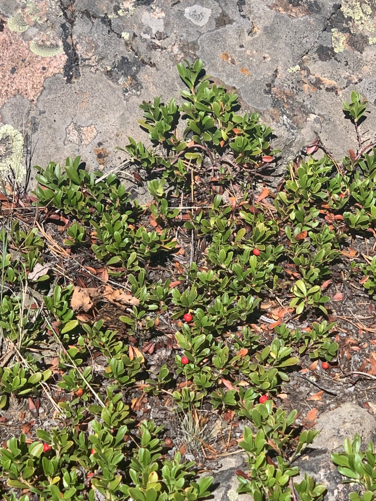
Bearberries 
Juniper berries 
Rose hips 
Wax currant 
Hoary Comma butterfly 
Elk thistle
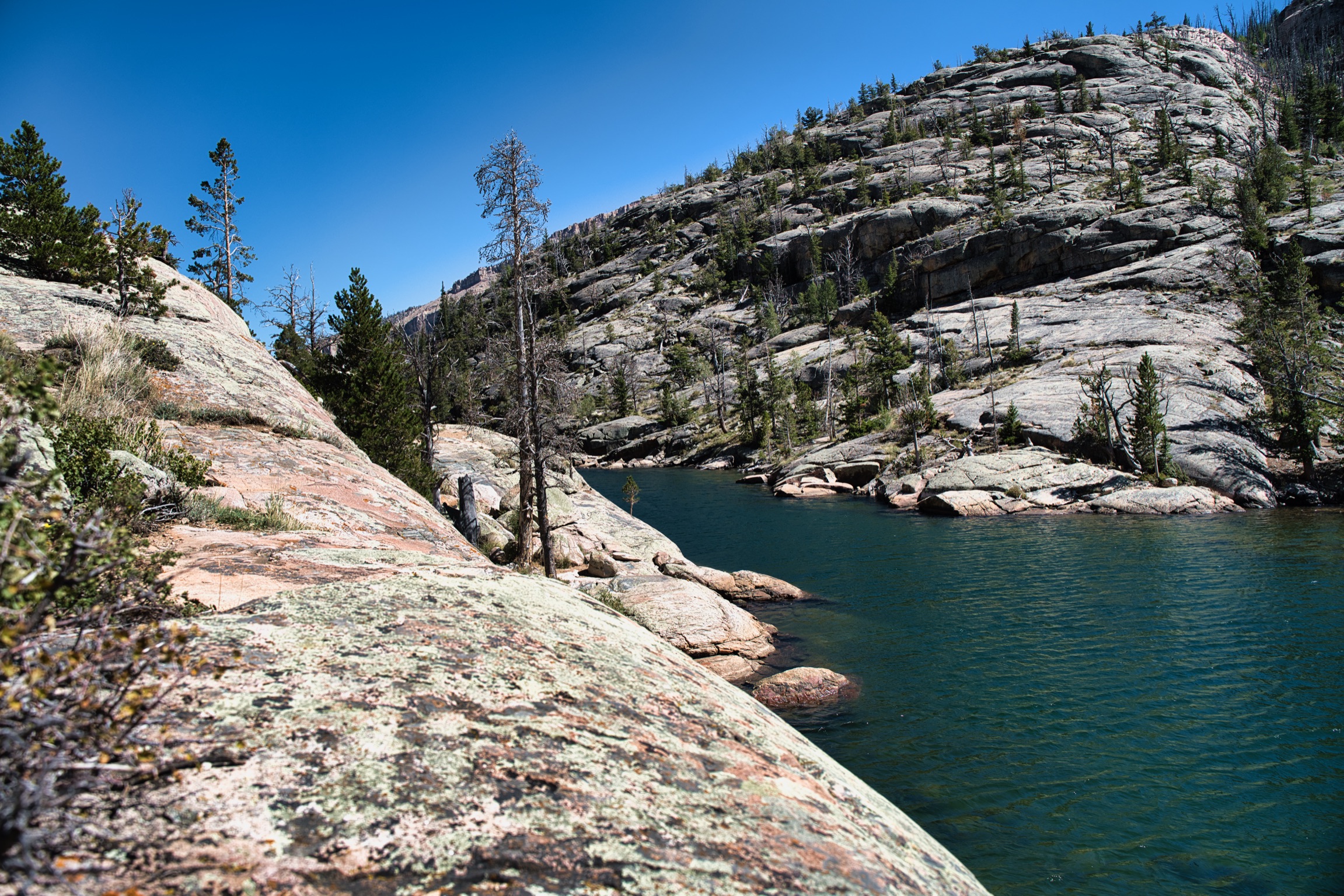
Off in the distance you can see the glacier that feeds the lake, and then where the lake feeds the waterfall. We both thought for those of you who have the wherewithal, bringing an inflatable kayak could be quite something to go and explore the farther reaches of this lake. It is really picturesque…check out my little video of the lake below. We even saw a cute little beach on the opposite side, which might be accessible if you walked all the way around the lake or had a kayak, but I cannot say for sure as the trail ends on the north end of the lake. We had a quick bite to eat while we saw chipmunks scampering about, edging ever closer to check out what we had and also saw some fish jumping in the lake. 🐿 🐟


There is still a bit of climbing to get back out, but it is generally much easier than the hike in, and you get an opportunity to check out the valley below and the large rock faces on either side of you. The western side has beautiful shades of burnt orange, coral, pink, and mauve within its layers. The eastern side is darker, but has an outcropping that almost looks like a putting green. Talk about extreme golfing! 😜 LOL The only annoyance was the amass of grasshoppers on the trail, which were very loud and sounded like a series of tasers going off all around you. But, we have seen oodles of these guys all through Montana, Idaho and Wyoming, so there is just no escaping them this time of year. All in all, this hike is small but mighty and a must-see if you are in the area. It gets two thumbs up in my book. 👍 👍


Dubois Town Park River Walkway:
If you are looking for something low-key to do, check out the River Walkway in downtown Dubois, Wyoming and take a relaxing stroll along the Wind River. It starts at the south end of Stalnaker St heading east on the south side of the Dubois Town Park. The signage upon entering was pretty funny, in my opinion, but the interesting part was learning about the town’s history and the animals that inhabit the area from the plaques located along the path.


Extend your walk across the bridge over the Wind River. The walk goes west for a short while and also east for more expansive views of the neighboring grazing land. The walk ends abruptly where it intersects with a dirt road called Harrison Dr.
There are numerous trails in the nearby Shoshone National Forest on your way to the Grand Tetons as well. No matter which direction you head, you will undoubtedly find some beautiful landscape to soak in and put a smile upon your face. 😊

Lake Louise looks amazing! Thanks for sharing!
LikeLiked by 1 person